Important Reading: Executive Summary Chesapeake Bay Oyster Recovery Master Plan March 2012 Draft

After you read this summary, take a look at Gov. McDonnell’s Feb 7 press release:  http://insidethecrater.com/?p=316

Virginia’s Oyster Harvests Boom
– 2011 Harvest was the Best Since 1989; 2012 Harvest May be Largest in 25 Years  – Over Past Decade Harvest Increases Ten-Fold: from 23,000 bushels in 2001 to 236,000 bushels in 2011; Dockside Value of Harvest Increased from $575,000 to $8.26 million

 How would the USACE Oyster Restoration Master Plan really affect Virginia?

U.S. Army Corps of Engineers 

DRAFT 

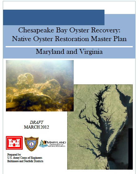
Chesapeake Bay Oyster Recovery:
Native Oyster Restoration Master Plan

March 2012

Forward 

The State of Maryland and the Commonwealth of Virginia are the local sponsors for this study. As such, the native oyster restoration master plan (master plan) was prepared in close partnership with the Maryland Department of Natural Resources (MDNR) and the Virginia Marine Resources Commission (VMRC). The National Oceanic and Atmospheric Administration (NOAA), the U.S. Fish and Wildlife Service (USFWS), and the U.S. Environmental Protection Agency (EPA), The Nature Conservancy (TNC), the Potomac River Fisheries Commission (PRFC), and the Chesapeake Bay Foundation (CBF) are collaborating agencies for the project.

EXECUTIVE SUMMARY

The eastern oyster, Crassostrea virginica, helped shape the Chesapeake Bay and the people that have settled on its shores. The demise of the oyster in the 20th century culminated from a combination of overharvesting, loss of habitat, disease, and poor water quality. The problems faced by the oyster in the Chesapeake Bay are not uncommon along the Eastern Seaboard of the United States (Jackson et al. 2001; Beck et al. 2011). However, oyster restoration in the Chesapeake Bay has proven challenging. Past restoration efforts have been scattered throughout the Bay and have been too small in scale to make a system-wide impact (ORET 2009). Broodstocks and reef habitat are below levels that can support Bay-wide restoration, and critical aspects of oyster biology, such as larval transport, are only beginning to be understood. However, even in their current state, oysters remain an important resource to the ecosystem, the economy, and the culture of the Chesapeake Bay region that warrant further restoration efforts. Comprehensive oyster restoration is paramount to a restored Chesapeake Bay. This native oyster restoration master plan (master plan) presents the U.S. Army Corps of Engineers’ (USACE) plan for large-scale, concentrated oyster restoration throughout the Chesapeake Bay and its tributaries.

This master plan represents the culmination of a highly intensive, transparent, and exhaustive effort to bring together state-of-the-art science, on the ground experience, and collaborative planning focusing on native oyster restoration in the Chesapeake Bay into one comprehensive and coordinated document. This effort, which builds on USACE’s Final Programmatic Environmental Impact Statement for Oyster Restoration Including Use of Native and/or Non-Native Oyster in 2009 (http://www.nao.usace.army.mil/OysterEIS/FINAL_PEIS/homepage.asp), is unprecedented in that it lays out the first comprehensive Bay-wide strategy for large-scale oyster restoration. Development of the document and the approaches laid out herein were accomplished painstakingly and with a thoroughness of purpose that this complex restoration challenge deserves. The authors and collaborators sought out the most up-to-date and credible sources of information to inform decision-making and plan formulation, including peer reviewed publications, and scientific and technical work accomplished by Bay experts, state partners, Federal collaborating agencies, non-government agencies, numerous stakeholders, and others with interest or expertise in native oyster restoration. Critical and controversial topics were isolated by the project team and analyzed through a series of Technical White Papers that were vetted among USACE, the project sponsors, and collaborating agencies. Intensive agency technical review of this document was accomplished by USACE with complementary reviews by other Federal and state partners to ensure technical quality and to address the full spectrum of technical and institutional concerns. Further public review of this document will complement the sound technical and institutional foundation on which this document has been built.

USACE, Baltimore and Norfolk Districts, have the authority under Section 704(b) of the Water Resources Development Act of 1986 (as amended by Section 505 of WRDA 1996, Section 342 of WRDA 2000, Section 113 of the FY02 Appropriations Act, Section 126 of the FY06 Appropriations Act, and Section 5021 of WRDA 2007) to construct oyster reef habitat in the Chesapeake Bay and have been designated as co-leads with the National Oceanic and Atmospheric Administration (NOAA) to achieve oyster restoration goals established by the Chesapeake Bay Protection and Restoration Executive Order (E.O. 13508) (May 15, 2009).

USACE restoration efforts have been ongoing in Maryland since 1995 and in Virginia since 2000. In recognition that a more coordinated Bay-wide approach is needed to guide USACE’s future Chesapeake Bay oyster restoration efforts and the investment of federal funding, USACE’s Baltimore and Norfolk Districts partnered with multiple agencies to create a joint Bay-wide master plan for oyster restoration efforts. Federal involvement is warranted due to the magnitude at which oyster populations have been lost in the Bay; the significant role oysters play in the ecological function of the Bay, as well as the socio-economics, culture, and history of the region; and the challenges confronting successful restoration. The purpose of this master plan is to provide a long-term strategy for USACE’s role in restoring large-scale native oyster populations in the Chesapeake Bay to achieve ecological success. It is conceivable that the master plan will serve as a foundation, along with plans developed by other federal agencies, to work towards achieving the oyster restoration goals established by the Chesapeake Bay Protection and Restoration Executive Order (E.O. 13508).

The master plan is a programmatic document that: (1) examines and evaluates the problems and opportunities related to oyster restoration; (2) formulates plans to restore sustainable oyster populations throughout the Chesapeake Bay; and (3) recommends plans for implementing large-scale Bay-wide restoration. The document does not identify specifically implementable projects.

The long-term goal or vision of the master plan is as follows:

Throughout the Chesapeake Bay, restore an abundant, self-sustaining oyster population that performs important ecological functions such as providing reef community habitat, nutrient cycling, spatial connectivity, and water filtration, among others, and contributes to an oyster fishery.

USACE recognizes that self-sustainability is a lofty goal. It will require focused and dedicated funding and strong political and public support over an extended period, likely decades. It will require the use of sanctuaries and the observance of sanctuary regulations. In addition to the long-term goal, the master plan defines near-term ecological restoration and fisheries management objectives. The ecological restoration objectives cover habitat for oysters and the reef community as well as ecosystem services.

The master plan lays out a large-scale approach to oyster restoration on a tributary basis and proposes that 20 percent to 40 percent of historic habitat (equivalent to 8 percent to 16 percent of Yates/Baylor Grounds) be restored and protected as oyster sanctuary. The concentrated restoration efforts are necessary to have an impact on depleted oyster populations within a tributary. To accomplish tributary-level restoration, the master plan includes salinity-based strategies to address disease and jumpstart reproduction.

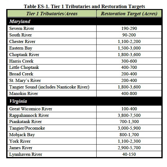
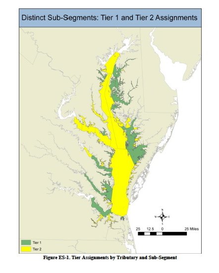
USACE and its partners evaluated 63 tributaries and sub-regions for their potential to support large-scale oyster restoration using salinity, dissolved oxygen, water depth, and hydrodynamic criteria. Salinity largely controls disease, predation, and many other aspects of the oyster life cycle and by its consideration, the master plan indirectly addresses these other factors. The evaluation was largely performed using geographic information system (GIS) analyses. The master plan identifies that 19 (Tier 1) tributaries in the Chesapeake Bay are currently suitable for large-scale oyster restoration (Table ES-1). These tributaries are distributed throughout the Bay with 11 sites in Maryland and eight sites in Virginia, as shown in Figure ES-1. Tier 1 tributaries are the highest priority tributaries that demonstrate the historical, physical, and biological attributes necessary to provide the highest potential to develop self-sustaining populations of oysters. The remainder of the tributaries and mainstem Bay segments are classified as Tier 2 tributaries, or those tributaries that have identified physical or biological constraints that either restrict the scale of the project required or affect its predicted long-term sustainability. The master plan also discusses additional criteria that should be investigated during the development of specific tributary plans such as mapping of current bottom substrate, sedimentation rates, and larval transport and provides a framework for developing specific tributary plans.

The restoration targets provided in Table ES-1 are estimates of the number of functioning acres of oyster habitat needed within a tributary to affect a system-wide change and ultimately provide for a self-sustaining population. The targets are not meant to be interpreted strictly as the number of new acres to construct. Any existing functioning habitat identified by bottom surveys would count towards achieving the restoration goal, but would not be counted toward new restoration benefits. Similarly, there may be acreage identified that only requires some rehabilitation or enhancement. Work done on that acreage would also count toward achieving the restoration target. The accounting of the presence and condition of existing habitat is recommended as an initial step when developing specific tributary plans. Once that information is obtained, restoration actions will be tailored to the habitat conditions and projected restoration costs (Table ES-2) revised.

The master plan includes planning level restoration costs that incorporate construction of high relief (12 inches) hard reef habitat (using shell and/or alternate substrates), seeding with spat (baby oysters), and adaptive management actions. Estimates are provided for the full construction of the low and high restoration targets. The summary of these costs for all Tier 1 tributaries is provided in Table ES-2. Estimates are conservatively high in that the assumption was made to develop the cost estimates that each acre would require construction of new hard habitat; however, it is anticipated that restoration will not require new habitat construction for every targeted acre. Although Table ES-2 concisely shows the costs for restoring all Tier 1 tributaries, one should not assume that all tributaries need to be restored before benefits are achieved. Further, USACE is not recommending an investment of this magnitude at any one time. Restoration should progress tributary by tributary. Benefits are achieved with each reef and each tributary that is restored. The master plan provides a further breakdown of costs by tributary and separate costs for substrate placement and seeding.

The ecosystem services provided by oysters are numerous (Grabowski and Peterson 2007), but largely difficult to quantify at this stage of restoration. These services include:

(1) production of oysters,
(2) water filtration, removal of nitrogen and phosphorus, and concentration of biodeposits (water quality benefits),
(3) provision of habitat for epibenthic fishes (and other vertebrates and invertebrates),
(4) sequestration of carbon ,
(5) augmentation of fishery resources,
(6) stabilization of benthic or intertidal habitat (e.g. marsh), and
(7) increase in landscape diversity.

Given the vast resources required to complete restoration in all Tier 1 tributaries and the fact that large-scale restoration techniques are in the early stages of development, USACE recommends choosing a tributary or two in each state for initial large-scale restoration efforts following completion of the master plan. This would facilitate the concentration of resources to enact a system-wide change on oyster populations in the tributary and achieve restoration goals, as well as provide for monitoring and refinement of restoration techniques. Monitoring will be guided by the report of the multi-agency Oyster Metrics Workgroup convened by the Sustainable Fisheries Goal Implementation Team of the Chesapeake Bay Program (OMW 2011).

Implementation of large-scale oyster restoration should begin with the selection of Tier 1 tributary(ies) for restoration by restoration partners. Specific tributary plans should be developed for the chosen tributary(ies) and should include a refinement of the restoration target, originally developed in the master plan. (NOAA has initiated development of a draft Tributary Plan Framework that is attached to the master plan in Appendix D.) Restoration partners should work together to acquire and evaluate mapping of current bottom substrates to initiate plan development and scale refinement. The master plan describes many other implementation factors that need to be considered during tributary plan development. Appropriate National Environmental Policy Act (NEPA) documentation would accompany each tributary plan. Once a tributary plan is complete, construction would proceed in a selected tributary by restoring a portion of the target (e.g., 25, 50, or 100 acres) per year given available resources until goals and objectives are met.

The master plan is proposing a sanctuary approach to fulfill USACE’s ecosystem restoration mission and the E.O. goals. In developing the master plan, USACE views oysters as “an ecosystem engineer that should be managed as a provider of a multitude of goods and services” (Grabowski and Peterson 2007). The recommendation for large-scale restoration in sanctuaries has been developed to concentrate resources, provide for a critical mass of oysters and habitat, and promote the development of disease resistance; this strategy is expected to be a significant improvement over past restoration efforts. Establishment of long-term, permanent sanctuaries is consistent with recommendations of the Chesapeake Research Council (CRC 1999), the Virginia Blue Ribbon Oyster Panel (Virginia Blue Ribbon Oyster Panel 2007), and the Maryland Oyster Advisory Commission (OAC 2008). Sanctuaries are necessary to enable the long-term growth of oysters, develop the associated benefits that increase with size, and develop disease resistance. Carnegie and Burreson (2011) also have proposed that sanctuaries may be a mechanism by which to slow shell loss rates.

Although limited, current information suggests that greater economic and ecological benefits are achieved through the use of sanctuaries (Grabowski and Peterson 2007; Santopietro 2008; USACE 2003, 2005). USACE is undertaking additional investigations into the costs and benefits of sanctuaries and harvest reserves. Future tributary plan development which will include applicable NEPA analyses and documentation will incorporate the findings of these investigations. Inclusion of management approaches other than sanctuaries will be considered in specific tributary plans, if justified. On the basis of current science and policy, USACE does support the efforts of others in establishing harvest reserves within proximity of sanctuaries to provide near-term support to the seafood industry and establish a diverse network of oyster resources.

There are a number of issues that may jeopardize the success of any large-scale oyster restoration program. Illegal harvests pose a major risk. Illegal harvests are suspected to have impacted nearly all past Maryland restoration projects as well as the Great Wicomico restoration efforts. Recent estimates are that 33 percent of oysters placed in Maryland sanctuaries between 2008 and 2010 have been removed by illegal harvests; a potentially greater percentage have been illegally harvested since the beginning of restoration efforts in 1994 (Davis 2011). Significant investments are lost and project benefits compromised when reef habitat is impacted by illegal harvests. The expansion of designated sanctuaries in Maryland and enforcement efforts by both Maryland and Virginia should help with reducing illegal harvests.

A second critical factor is the availability of hard substrate for reef construction. Oyster reef is the principal hard habitat in the Bay and significant amounts of reef habitat will need to be restored to meet restoration goals. However, a sufficient supply of oyster shell is currently not available for oyster restoration. Alternate substrates will need to be a part of large-scale habitat restoration. Alternate substrates such as concrete and stone are significantly more expensive and may not be publicly acceptable on such a large-scale; however, these materials greatly eliminate the risk of poaching because the materials can damage traditional harvest equipment. A third issue impacting the success of large-scale oyster restoration is water quality. A restored oyster population has the potential to return filtering functionality to shallow water habitat in the Bay. However, poor land management and further degradation of water quality will jeopardize any gains. Ultimately, water quality benefits provided by oyster restoration will rely on sustainable land management and development. Efforts being undertaken to support the Chesapeake Bay Restoration and Protection Executive Order and the nutrient reduction goals established in the Chesapeake Bay Total Maximum Daily Loads (TMDL) will help address water quality issues. The Executive Order goals targeting water quality, habitat, and fish and wildlife are directly related to achieving the goals presented in the master plan. Opportunities to match oyster restoration efforts, spatially and temporally, with land management projects should be implemented to the greatest extent.

Although USACE and its partners have developed this master plan to guide USACE’s long-term oyster restoration activities, large-scale oyster restoration in the Chesapeake Bay will only succeed with the cooperation of all agencies and organizations involved. VMRC and USACE-Norfolk are working together towards some common ground activities including oyster benefits modeling, a fossil shell survey, monitoring, and rehabilitation of existing sanctuary reefs; and these efforts should continue in the future. Resources and skills must be leveraged to achieve the most from restoration dollars. The greatest achievements will be made by joining the capabilities of each agency in a collaborative manner to pursue restoration activities.

Link to the full report:

Click to access CB_OysterMasterPlan_March2012_LOW-RES.pdf

Good Turnout for TMDL Meeting – But We Missed the Part About The Army Corps of Engineers And Oyster Sanctuaries

About 50 people came to the TMDL meeting in Hartfield, including Mathews County Supervisor Janine Burns and Planning Director John Shaw. About the biggest piece of new information was the BST test– bacterial source tracking — is no longer being used to identify the most likely source of fecal coliform contamination. That takes care of concerns over accuracy of the tests, but we don’t know yet how, or if, specific sources can be determined at this point.

As most of those attending expected, septic systems, agricultural practices, livestock and pets were cited as the areas the implementation plan will target. Wildlife, including Canada geese, were initially dismissed as a significant factor, but the residential/recreational workgroup did get a recommendation on record to involve DGIF or other agencies in exploring this aspect of the problem. It’s still unclear why agencies involved with wildlife are not participating in TMDL meetings from the beginning, if only to provide fact sheets and a point of future contact.

The Department of Environmental Quality (DEQ, along with the Departments of Conservation and Recreation (DCR) and Mines, Minerals and Energy (DMME), issued a TMDL Six Year Progress Report for 2000 – 2006, in March, 2007. In discussing the challenges faced in the Metro Richmond area, the report cited: “Wildlife (such as geese, ducks, beaver, & deer) likely contributes to the impairment.  Methodologies to address these sources may need to be explored and evaluated.” (If there are more recent reports about the results of such evaluations, they’ll be reported here as soon as they’re identified.)

Questions about possible discharges from boats caused heated exchanges, as did the question of the necessity to attempt to bring impaired waters up to the strict standards necessary for shellfish cultivation. For Virginia to continue interstate sales of shellfish, there is no option other than for the state to continue to monitor and report on all shellfish shoreline areas and to develop plans to attempt to clear up impaired waters.

The lack of a sound system and projected graphs and charts that were only visible from the front rows added to the charged atmosphere at times, but overall, the meeting was civil, and DEQ and DCR representatives and residents in attendance were able to express their points of view. There were questions left unanswered due to the time restraints, but by the next meeting, answers should be available on all of them.

This process leading to the creation of TMDL Implementation Plans is not going to be quick or easy. Some of the possible BMPs (Best Management Practices) presented at the meeting may be helpful. We’ll know better after these are reviewed and considered in depth.  I do believe the people involved on all sides are sincere and care about the results, and that the IPs will not just be cookie-cutter versions of other IPs. There is a lot of work to be done locally to achieve that result.

But just when I thought we had a sense of how this whole TMDL process works, we learned from a Southside Sentinel article that the Army Corps of Engineers has plans in progress for the Piankatank and other rivers in the Chesapeake Bay watershed in Maryland and Virginia involving oyster sanctuaries, a fairly significant detail not mentioned in the TMDL meeting, and not at all obvious on either the DEQ or DCR websites. I’ve looked at a lot of TMDL related documents the past few weeks, and the Army Corps of Engineers and oyster sanctuaries didn’t pop out anywhere. A quick look at the Norfolk District Army Corps of Engineers website found this image-link:

http://www.nao.usace.army.mil/News/20120329_PublicMeetingsOysterRestoration.asp
to a public meeting notice about “native oyster restoration plans for VA, MD” and that notice said in part, “The long-term goal is to restore an abundant, self-sustaining oyster population that performs important ecological functions such as providing reef community habitat, nutrient cycling, spatial connectivity, and water filtration, among others, and contributes to an oyster fishery.”
Sounds great, except for what I read in the Sentinel article and in a quick look at “The Master Plan.” Guess I have some homework to do this weekend.

Are Year-round Geese Part of the Water Contamination Problem?

Sunset facing mouth of Queen’s Creek courtesy of Davie Cottrell©

Each impaired shellfish area has unique challenges, so this post is only about Queens Creek, which is listed in the 2007 Gwynn’s Island-Milford Haven watershed TMDL report. It states “septic systems should be a primary implementation focus because of health implications….” Like many official statements, it sounds good at first hearing, but if septic systems are failing near Queens Creek, why would the human contamination drop to 0% on any month’s reading, much less for 3 of 6 readings taken between October, 2005 to August, 2006? But Figure 4.6 B shows 74% for the average annual fecal coliform contributions from wildlife.

Residents on Queens Creek have seen the geese population go from staying half the year to settling in year-round. Does that have anything to do with the high wildlife contributions? Can’t tell from the reports because the details aren’t provided, only totals and percentages for ‘wildlife’.

Mouth of Queen’s Creek courtesy of Davie Cottrell©

Other questions are, “Do the geese increase the phosphorus load too? Are they causing any additional shoreline erosion by eating young shoots?”

 And we need to consider whether there are other conditions that  are making the situation worse? Where are the computer models for evaluating the impact of the lack of dredging? The waters in Queens Creek used to be navigable, but they’re not for many craft today. If the Creek is dredged, would more water flow in and out with each tide change the capacity to process the impact of wildlife contamination? How much has settled in the silt at the bottom of the shallower creek to be stirred up by storms? (And on a separate point, if dredged material is spread in the sun, can the natural UV  disinfect it so it would then be usable to nourish the marshes that are being eroded by wave action and storms?)

But as things stand, continual contamination means the waters have no possibility of recovery naturally, so what happens to the areas further downstream?

The report acknowledges that for some areas, “water quality modeling indicates after removal of all of the sources of bacteria (other than wildlife), the stream will not attain standards under all flow regimes at all times. However, neither the Commonwealth of Virginia, nor EPA is proposing the elimination of wildlife to allow for the attainment of water quality standards….The reduction of wildlife or changing a natural background condition is not the intended goal of a TMDL.”

What is their plan? Even if all the effluent, pet and livestock elements are reduced as far as humanly possible, according to the 2007 report, the bottom line is the state agencies don’t plan to do anything–except change the assigned use of the waters–probably permanently.

It’s relatively easy for TMDL plans to go after the obvious 8% human element, 9% livestock and 9% pet contamination the state tests indicate. It’s not going to be easy to deal with the rising population of geese, but information is available about how to address the problem. Now we have to see if our state agencies are going to go beyond the obvious and deal with the 74% of bacterial contamination attributable to wildlife. Wonder if we’ll find out on the 23rd.

TMDLs? Mathews Residents Need To Figure Out How to Play This Numbers Game on May 23, 2012

I don’t think you can find anyone who will say they want dirty, fecal-contaminated water in their rivers, creeks and bays. But there are no easy answers for how to clean them up, or even how to guess how many potential sources there are. Yes, I said guess, because most of the reporting comes from computer modeling based on computer generated land use maps. Short of going out and counting every dog, raccoon, deer and duck, the best we can do is an educated guess.

<<JUST IN: IMPLEMENTATION PLAN SIMILAR TO WHAT WE CAN EXPECT:Greenvale Creek Implementation Plan>>

But we can apply common sense and general knowledge to refine those computer models. We’re on a deadline here: a public meeting has been called for May 23rd at the YMCA in Hartfield, 6:30 – 8:30 pm, for Mathews, Middlesex and Gloucester residents.   DCR Meeting Notice 5-23   It’s up to us to show up and share what we know. We need to question what doesn’t make sense in the old reports too — before the same information is passed along to the plans that will follow this meeting.

Shellfish Factsheet What we know right now is the Department of Environmental Quality defines TMDLs (Total Maximum Daily Load) as “the total pollutant a water body can assimilate and still meet standards.” And there are 9 creeks feeding into the Gwynn’s Island/Milford Haven Watershed or Piankatank River and parts of the Piankatank that are impaired and have levels of fecal coliform bacteria that are too high for growing shellfish.

If more information turns up, I’ll add to this post. Links to the old reports follow, with maps that show the areas involved.  See you at the meeting on the 23rd!

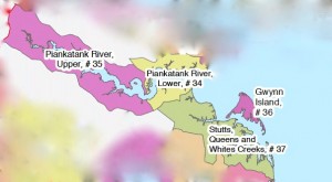
The impaired waters being discussed are located in these VA Dept of Health Shellfish Growing Areas

TMDL Report Gwynn’s Island and Milford Haven Watersheds

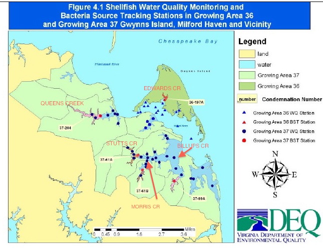
Gwynn’s Island and Milford Haven Watersheds shown in green

TMDL Lower Piankatank River

TMDL Modified Report Lower Piankatank River

TMDL Report Upper Piankatank River

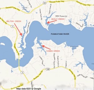
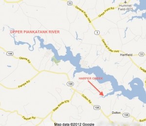
5 Creeks in Gwynn’s Island-Milford Haven Watershed With Impaired Shellfish Waters


Wilton, Healy and Cobbs Creeks

Upper Piankatank River and Harper Creek


Wetlands Plant Indicator Categories Changed — and so did the definitions

When I first wrote this story, I was excited that I received a helpful and rapid response from the U.S. Army Corps of Engineers within 3 hours of my emailed inquiry about the 2012 National Wetland Plant List:”Good timing with your message, the National Wetland Plant List (NWPL) has been finalized and a notice was published in the Federal Register today [May 9, 2012]… https://www.federalregister.gov/articles/2012/05/09/2012-11176/publication-of-the-final-national-wetland-plant-list.  The NWPL officially becomes effective on 01 June 2012.”

Loblolly pines are a familiar sight in Mathews

The 2012 National Wetland Plant List shows Pinus taeda (loblolly pine), and   Liquidambar styraciflua (Sweet Gum) as FAC.  FAC used to mean Facultative, equally likely to occur in wetlands or uplands.  I thought that with the new list recognizing plants like loblolly pine and honeysuckle as very adaptable and not limited to wetlands, the same idea would be carried through in the rest of the listings–and future wetlands delineation decisions would be more rational than in the past.

But not only did the panel add 1,472 plants to the original 6,728 species, they changed the definitions of their wetland indicator classifications as well.

OLD OBL – Obligate Wetland: Occurs almost always (estimated probablility 99%) under natural conditions in wetlands.
2012 OBL: Plants that always occur in standing water or in saturated soils

OLD FACW – Facultative Wetland: Usually occurs in wetlands (estimated 67% – 99%), but occasionally found in non-wetlands
2012 FACW: Plants that nearly always occur in areas of prolonged flooding or require standing water or saturated soils but may, on rare occasions, occur in nonwetlands

OLD FAC – Facultative: Equally likely to occur in wetlands or nonwetlands (estimated probability 34%-66%)
2012 FAC: Plants that occur in a variety of habitats, including wetland and mesic to xeric nonwetland habitats but often occur in standing water or saturated soils

OLD FACU – Facultative Upland: Usually occurs in nonwetlands (estimated probability 67-99%), but occasionally found on wetlands (estimated probability 1%-33%)                       
2012 FACU: Plants that typically occur in xeric or mesic nonwetland habitats but may frequently occur in standing water or saturated soils

OLD UPL – Upland: Occurs in wetlands in another region, but occurs almost always (estimated probability 99%), under natural conditions in nonwetlands in the regions specified. If a species does not occur in wetlands in any region, it’s not  on the National list.
2012 UPL: Plants that almost never occur in water or saturated soils

If the new FAC had stayed with “equally likely to occur in wetlands or nonwetlands,” we’d be in good shape. As it is, future delineations are probably going to be wetlands-biased, especially when FACU includes plants that grow in xeric (arid) regions, but also in standing water or saturated soils. They must be counting flash floods after storms to get that one in.

Take a few minutes and read the Federal Register entry. It provides some interesting background information on the comments from those on the reviewing panel who did not agree with the final decisions. Perhaps the planned challenge studies to test the new list will bring some adjustments. And when they set up the system again to search by county, it might be a good idea to download the local listings before visiting a nursery for landscape plants. Save those labels so you know the scientific names of whatever nonwetland plants you add to your plantings.

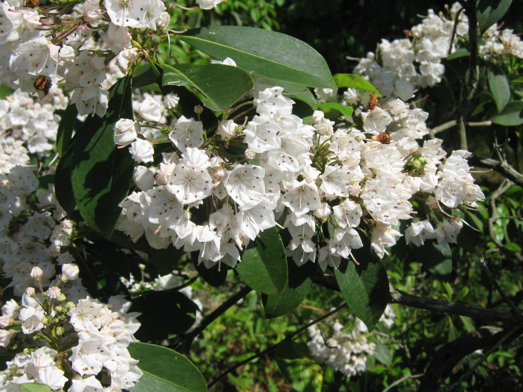
To leave you on a pleasant note, these are mountain laurel, Kalmia latifolia – FACU, growing in Mathews, and they aren’t in standing water or saturated soil.

Mountain Laurel (Kalmia Latifolia)  FACU

Mountain Laurel (Kalmia latifolia) FACU

New Point Comfort Development Company’s Plans: A Mathews Resort – But Only On Paper

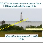
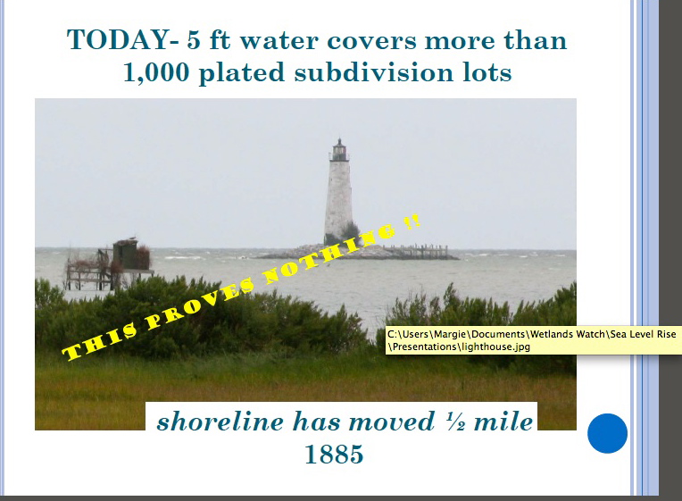
The last post showed this Wetlands Watch slide used in a Middle Peninsula Planning District Commission presentation.

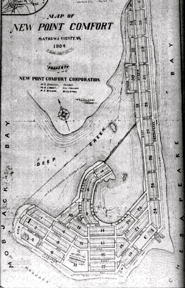
It’s true you’ll find water and some marshes today where the lots were shown on a 1904 Mathews County subdivision map near the lighthouse. But what the MPPDC/Wetlands Watch slide doesn’t say is the development company planned to fill in the tidal marshes and bring in sand to create beaches. The New Point Comfort Lighthouse site online says that the enormous cost to carry out that plan is what caused the company to go out of business the following year.

New Point Comfort Development Company Subdivision Plan – 1904


So what happened to the tidal marshes, sandbars and shoaled areas that existed in 1904 and earlier? And what about the photos and stories of people a generation or two ago who went to sandy beaches at New Point for picnics and outings?

Sand moves with the wind and waves. It is washed away, and bars and beaches reform at another place if there’s enough material available. But major storms can play havoc with that process. The Office of Naval Research describes one kind of current along the coast called the Longshore Current, how it moves, and how it can cause powerful and dangerous rip currents.

There’s an animation of the wave action that can produce sandbars on ONR’s educational Science and Technology Focus website at: http://www.onr.navy.mil/focus/ocean/motion/currents2.htm

With hurricanes and some other storms, the low pressure system increases the speed of longshore currents and height of waves. When these stronger longshore currents produce rip currents, they excavate channels through sandbars. The sand then accumulates in a quieter areas forming new bars. In this way, depending on the number and types of storms, and the intervals between storms, sandbars appear to migrate. When sand is exposed and dry, the wind then moves it to build up beaches–or blow them away. Beaches can only build up when dry sand is available. If the angle of a beach changes, so that the sand remains wet, the beach will not grow and can be diminished by wave action or the effects of storms.

The Chesapeake – Potomac Hurricane of August 23rd, 1933 and the one that hit on September 16th, 1933  ripped through the area around New Point Comfort, leaving two separate islands we see today. But the New Point Comfort Lighthouse withstood the tremendous winds and rain and waves, and isn’t that the story that really matters?


The Shoreline’s Moved 1/2 Mile–if Sandbars Count as Shoreline

The shoreline that moved was mostly sandbars washed away by storms and waves.

This slide was used in a Middle Peninsula Planning District presentation at a  Virginia Coastal Partners Workshop in 2010.  An eye-catching headline, a dramatic image, a subhead intended to reinforce an idea. Wetlands Watch supplied MPPDC with the image, and both organizations used the same picture in separate presentations at the same workshop.

Wetlands Watch used the line, “Climate Change Impacts Can be Seen in Virginia” along with “From 1885 to now–the shoreline has moved 1/2 mile.” The banner across the center of the MPPDC slide says: “THIS PROVES NOTHING!!” To which I can definitely say, You’re right!  This doesn’t prove any sea level rise; it doesn’t prove climate change; and there’s a lot more to this story.

Virginia Institute of Marine Science (VIMS) did a site assessment of the New Point Comfort Lighthouse in 2008, and they noted that “erosion has always been an issue at the New Point Comfort.” The lighthouse was built on a peninsula connected to the mainland by a sandbar. Between the time the lighthouse was built in 1804 and 1832, immense areas of sand had been moved by storms, waves and wind. What follows here is the story of what was done to try to protect the lighthouse during those years, not from rising water levels, but from the relentless scouring of sand from the lighthouse island by waves and wind and storms.

The keeper reported after the Great Coastal Hurricane of 1806 that “a considerable part of the beach washed away & one of the landmarks <indicating the boundaries> was washed up, that was at the distance of 45 feet, when the public land was laid out from highwater mark.”(Candace Clifford, New Point Comfort Light Station – Historical Documentation, 2001) “This hurricane, due to its slow movement and consequent erosion of the coastline completed the formation of Willoughby Spit. A seawall built to prevent further erosion at Smith Point Lighthouse was damaged.” (http://www.hpc.ncep.noaa.gov/research/roth/vaerly19hur.htm)

In 1814, the first report of the extensive damage the British did to the lighthouse in the War of 1812 suggested the lighthouse should be destroyed if the war continued because it was being used as a watchtower, and “the water already washes its base and in a few years will undermine it.” (Clifford, 2001 quoting from the National Archives.) That advice was not followed and in 1815, the original builder recommended 156 pilings of 12-14 ft be sunk 5-6 ft in the sand, and another 100 opposite the house to protect it.

A year later, sand had begun to collect around the pilings and the lighthouse was considered secure. Unfortunately, by 1822, those pilings had rotted in the ground. A stone wall was then approved in 1825, and still more repairs and additional work were done in 1832.

The National Archives holds a request for a boat in 1839 because, “There is now two miles of water communication necessary where until lately there was a ford at low tide.”  In 1846, the keeper reported the “publick buildings were completely surrounded by tidewater.” (Candace Clifford, 2001)

The lighthouse was put out of commission during the War Between the States in 1861, restored in 1865, and once again, a boat was requested for the keeper in 1866. Sand moved and shoals formed in the decades that followed, and gales and hurricanes moved and changed them as they always have. But that’s a function of weather, normal, ordinary weather–capricious and unpredictable, not because of climate change.

The next post will take a look at what happened to the 1904 1,000 lot subdivision of the New Point Comfort Development Company. Or, perhaps more accurately, what didn’t happen.

*   *   *

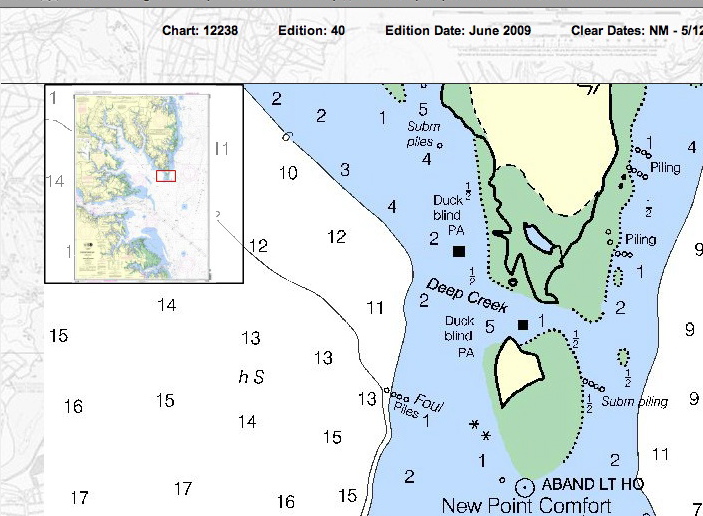
Below is a detail from NOAA Nautical Chart 12238, showing water depth in feet in 2009 around New Point Comfort Lighthouse island. (Green areas are marshes.) One small area to the northwest, between the lighthouse and the shoreline is 5 ft as the MPPDC/Wetlands Watch slide said, but north, past a marshy area, it’s 1 ft; to the northeast, 1/2 ft, and east-northeast, 2 ft.


The New Point Comfort Lighthouse

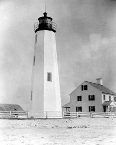
New Point Comfort Lighthouse, date unknown, possibly late 1800’s


The New Point Comfort Lighthouse is on an island off the southern tip of Mathews County. It’s the 3rd oldest lighthouse surviving in the Bay, the 10th oldest in the Country, and it’s on the National Register of Historic Places. Efforts are underway to preserve it for the future. (Photo courtesy of the U.S. Coast Guard and the National Archives.)

There’s a great video and a lot of information here: http://www.newpointcomfortlighthouse.org/

There’s also a concise and well-written history on the Lighthouse Digest site:  http://www.lhdigest.com/Digest/StoryPage.cfm?StoryKey=2304

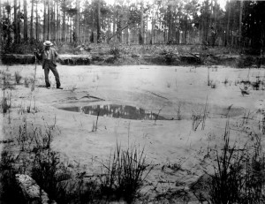
Photo on Ten Mile Hill shows the effect of liquifaction where the intense shaking caused the water to rise and mix with the sand, forming a craterlet with puddled water at the bottom after the shaking stopped.

The lighthouse was completed in 1804, and has survived a number of storms, the War of 1812, and the Charleston Earthquake of August 31, 1886, which shook seven states from South Carolina to New York. Aftershocks  continued for days afterwards, but the lighthouse withstood them all.

(Photo courtesy of U.S. Geological Survey; Photo by C.C. Jones, September 1886. Plate 20, U.S. Geological Survey Annual Report 9, 1887-88)

Currently, the lighthouse is being used as an example of the imminent danger from sea level rise caused by global warming. My next post is going to show why that’s not quite the case.

Beneath the Surface

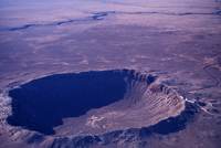
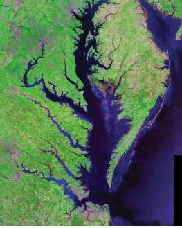
The Chesapeake Bay Impact Crater’s central area is about 56 miles (90km) across, making it the largest in the United States and the 6th largest in the world.  To give you an idea of what the crater would look like if it weren’t under the Bay and filled with marine sediments, take a look at this photo of the Barringer Crater in Arizona, about 600 ft deep and 4,000 ft in diameter. (Image Courtesy: Michael Collier; Image source: Earth Science World Image Bank, Copyright Michael Collier. http://www.earthscienceworld.org/image)         

(Landsat photo courtesy of U.S. Geological Survey)

Our Chesapeake Bay Impact Crater kept its identity a secret for a good bit of its 35 million year existence. Some material was vaporized when the bolide struck; some was thrown into the air and fell back in a jumble; some was melted and flung into the air, falling as glassy blobs called tektites as far away as Georgia and Texas. Over the eons, marine sediments filled in part of the crater and disguised its origin.

But it was the discovery of “shocked” quartz in undersea core samples off the New Jersey coast that led C.Wylie Poag, chief scientist on the Glomar Challenger, to search for the impact area. There’s a great article at http://meteor.pwnet.org/impact_event/impact_crater.htm with excellent photographs and explanations.

So now you know about what’s under Mathews County. In the next post, I’m going to start talking about some of our special places and things happening in Mathews.

CJ

The Crater Rim–Hiding in Plain Sight

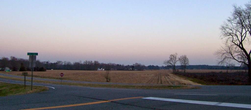
Driving through Mathews towards Gloucester Courthouse, when woods don’t obscure the view, you can see that the slope of the land is relatively flat.

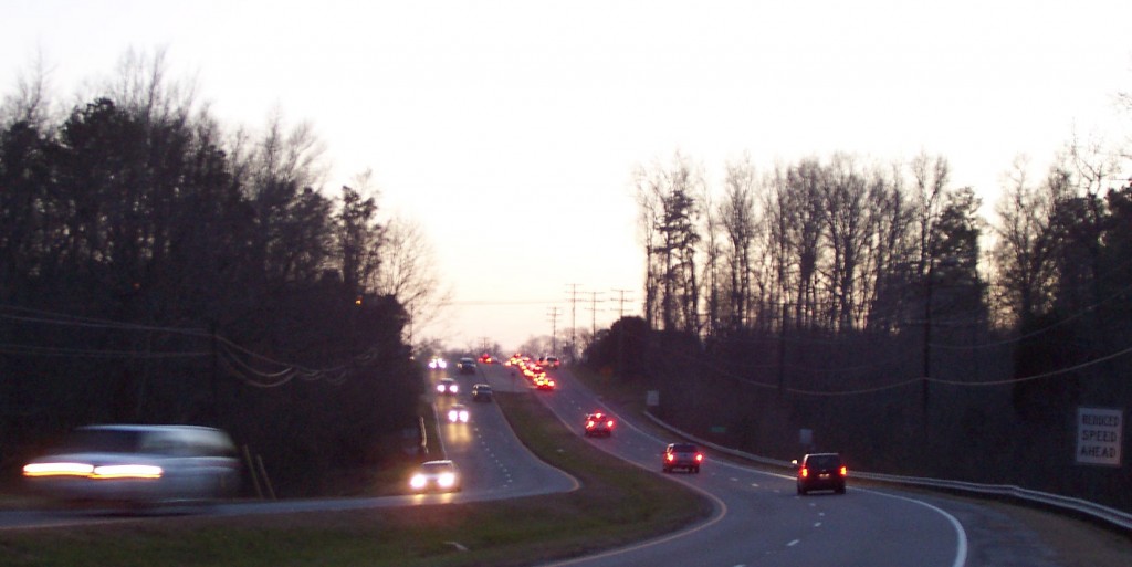
As you approach Main Street in Gloucester though, there is an unexpected sharp rise.

Very high compared to the surrounding areas, but not that impressive–until you learn this is the very top of the wall of the Chesapeake Bay Crater rim which extends down somewhere between 1,000 and 4,000 feet.  Now that’s impressive.