Woke Geology from the Washington Post

By Carol J. Bova

The Washington Post published a piece June 4, 2021, on the geologic origins of Mid-Atlantic summer destinations, many in Virginia. Its wrap-up switches into Woke doctrine and describes the Chesapeake Bay as “a case study in climate change…Efforts are on to mitigate the effects of rising water on islands in the bay and the cities and towns along it.” The article warns, “Climate change may have brought the bay into being, but now human-caused climate change endangers it… will the Chesapeake Bay itself cease to exist, subsumed by the Atlantic?”

Dramatic. Of course, there was no place for mention of the impact crater that provided the depression in which the Bay formed. The article refers to the melting glaciers of 10,000 years ago. No mention, though, that during each of the five Ice Ages going back to 2.4-2.1 billion years ago, glacial periods have always been followed by interglacial periods when the temperatures rise, or that we’re still in one.

Of course no mention of the land subsidence from the excessive drawdown of water in the Potomac and related aquifers by Virginia, D.C., Maryland, Delaware, and New Jersey. And certainly no mention of the role of that subsidence in relative sea-level rise in the Chesapeake Bay region, especially in Hampton Roads.

Instead of those inconvenient details, it was much easier to rely on the mantra of “human-caused climate change.”

The National Watershed Boundary Dataset – Chesapeake Bay Watersheds and Virginia River Basins

By  Carol J Bova

In 2001, the National Watershed Boundary Dataset (NWBD) became the official hydrologic unit system of the United States. Virginia made some adjustments to simplify identifying smaller watershed units. You might never need the details here, but if you do, this should help because an accurate list is not always easy to locate. A special thank you to Sam Austin and Randy McFarland of the USGS for their help.

Watershed Hydrologic Unit Code (HUC) Level, Name and Unit Size

1st Order = Region            HUC = 2 digits         Avg. 177,560 sq. miles

2nd Order = Subregion      HUC = 4 digits         Avg. 16,800 sq. miles

3rd Order = Basin              HUC = 6 digits         Avg. 10,596 sq. miles

4th Order = Subbasin         HUC = 8 digits         Avg. 703 sq. miles

5th Order = Watershed       HUC = 10 digits       40,000 – 250,000 acres

6th Order = Subwatershed   HUC = 12 digits     10,000 – 40,000 acres

The Virginia Department of Conservation and Recreation (DCR) describes River Basins as follows:  Although 3rd level units of the WBD are called “Basins,” these units are not necessarily the equivalent of river basins as described in many state programs. For instance, DCR frequently divides the commonwealth into 14 River Basins for program usage as follows: Potomac River, Rappahannock River, York River, James River, Atlantic Ocean Coastal, Chesapeake Bay Coastal, Chowan River, Albemarle Sound Coastal, Roanoke River, Yadkin River, New River, Clinch-Powell Rivers, Holston River and Big Sandy River. Except for offshore ocean claims, all of Virginia is accounted for in these basins.

Virginia developed a new four-character code for its 5th and 6th level units. The first two characters are based on the major stream name in the basin, or portion of the basin, where the unit is located. The two digits that follow are numbered in sequence by drainage flow from headwaters to mouth.

These four-character identifiers are not part of the national WBD standard. The Virginia system is called the Virginia National Watershed Boundary Dataset (VaNWBD). Originally released in 2006, the VaNWBD has been updated a number of times, and currently is referred to as version 5 (VaNWBDv5).

The Department of Conservation and Recreation (DCR) website lists the internal coding for all 5th and 6th level units of the VaNWBDv5 at http://www.dcr.virginia.gov/soil-and-water/hu. The Virginia coding for 5th and 6th level units for the Chesapeake Bay watersheds and sub-watersheds of the VaNWBDv5 from Table 4 shown below.

CHESAPEAKE BAY VIRGINIA WATERSHEDS AND SUB-WATERSHEDS
5th LEVEL UNITS (VAHU5) 6th LEVEL UNITS (VAHU6) DRAINAGE
PL-A – PL-U PL01-PL74 Potomac River, Lower
PU-A – PU-F PU01-PU22 Potomac River, Upper
PS-A – PS-T PS01-PS87 Potomac River-Shenandoah River
CB-A – CB-O CB01-CB47 Chesapeake Bay/Chesapeake Bay Coastal
AO-A – AO-H AO01-AO26 Atlantic Ocean Coastal
RA-A – RA-R RA01-RA74 Rappahannock River
YO-A – YO-S YO01-YO69 York River
JL-A – JL-L JL01-JL59 James River, Lower (Tidal)
JM-A – JM-U JM01-JM86 James River, Middle (Piedmont)
JR-A – JR-E JR01-JR22 James River- Rivanna River
JU-A – JU-T JU01-JU86 James River, Upper (Mountain)
JA-A – JA-J JA01-JA45 James River- Appomattox River
CM-A – CM-H CM01-CM32 Chowan River-Meherrin River
CU-A – CU-R CU01-CU70 Chowan River, Upper
CL-A – CL-C CL01-CL05 Chowan River, Lower
AS-A – AS-D AS01-AS20 Albemarle Sound
RU-A – RU-V RU01-RU94 Roanoke River, Upper
RD-A – RD-S RD01-RD77 Roanoke River- Dan River
RL-A – RL-G RL01-RL24 Roanoke River, Lower
YA-A – YA-B YA01-YA07 Yadkin River-Ararat River
NE-A – NE-Z NE01-NE90 New River
TH-A – TH-L TH01-TH46 Tennessee-Holston River
TC-A – TC-H TC01-TC35 Tennessee-Clinch River
TP-A – TP-D TP01-TP19 Tennessee-Powell River
BS-A – BS-H BS01-BS35 Big Sandy River


Excerpts and Errors from the Middle Peninsula All Hazards Mitigation Plan — Another Installment of Accuracy Not Guaranteed

                                                                  By Carol J. Bova

There are so many major and minor mistakes about Mathews County in the regional All Hazards Mitigation Plan, there’s no easy way to address them at one time. Maybe it’s time to start an ongoing catalog of them to get a head start on the 2021 Mitigation Plan. We learned with previous reports like the Regional Water Supply Plan that there’s a very slim window for public input, and once a report is written, MPPDC has no interest in changing it. Even when citizens presented information at a meeting of the MPPDC about the Roadside and Outfall Ditch Report and asked that the report not be accepted until corrected, they acknowledged the errors and accepted it anyway, saying they’d correct it afterwards. The result: MPPDC staff decided there were no errors, and the mistakes in it continue to be recycled in newer reports, like the recent Virginia Coastal Policy Center’s Ditch Maintenance Study. That one involved a $40,000 grant, examined one ditch, and came up with the wrong answers, largely due to the influence of the earlier MPPDC reports. (More on that in a future post.)

With that background in mind, let’s look at the Hazards Mitigation Plan. The Plan is 556 pages, divided into 5 parts. They are available at mppdc.org.

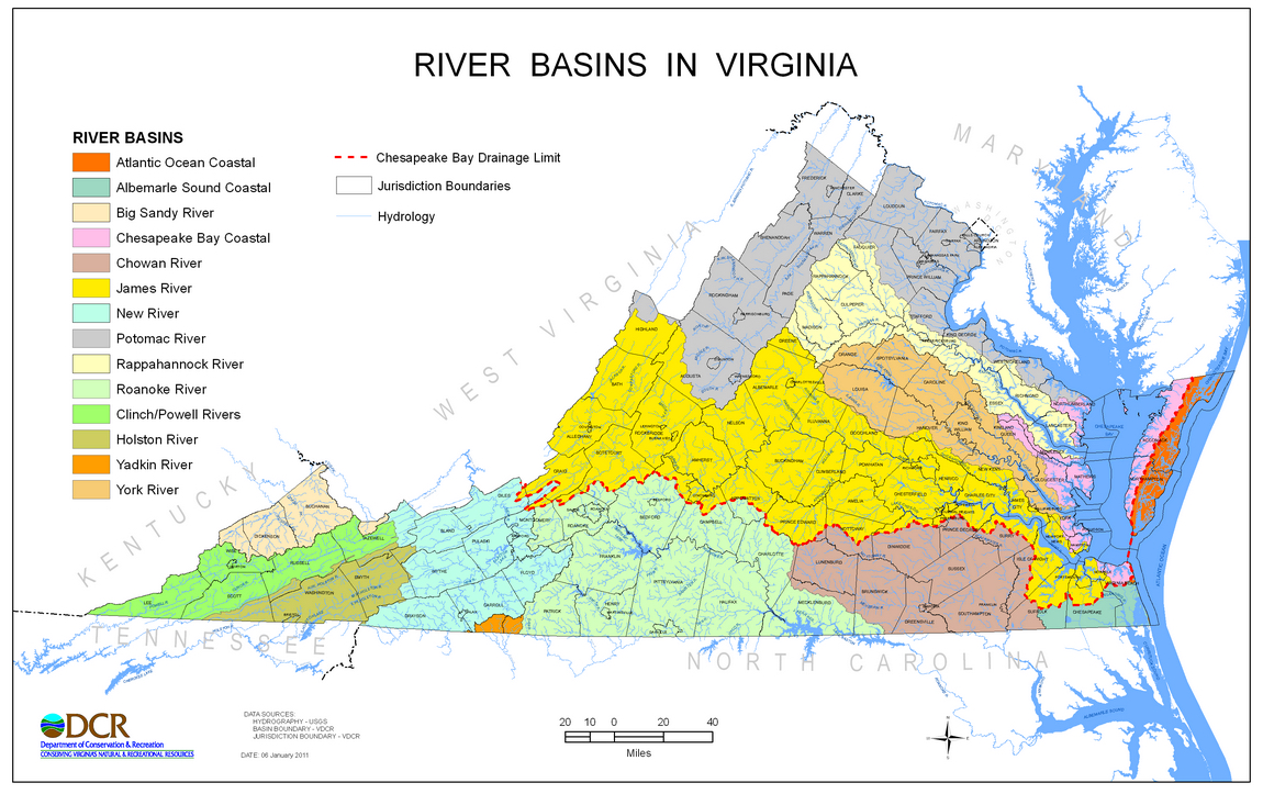
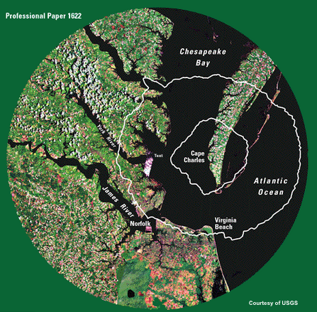
Mathews County is located at the eastern tip of the Middle Peninsula. The County is bordered mostly by water, with the Chesapeake Bay to the east, the Mobjack Bay to the south, the North River to the west, and the Piankatank River to the north. Except for approximately five miles that border Gloucester County, the County’s perimeter is formed by its 217 mile shoreline. (Part1, pg. 16.)

The name and location are correct, and a peninsula is largely bordered by water. A few minor details are off, like the Chesapeake Bay is to the east and south of Mathews, and the western border includes Mobjack Bay along with the North River and the Gloucester County line. The miles of shoreline number is off by 130 miles. The Virginia Institute of Marine Science reported 347.42 miles of shoreline on page 20 of the 2008 Mathews County Shoreline Inventory. Eight years should have been long enough for the MPPDC to become aware of the fact.

Image Courtesy of FEMA Region III (red notes added)

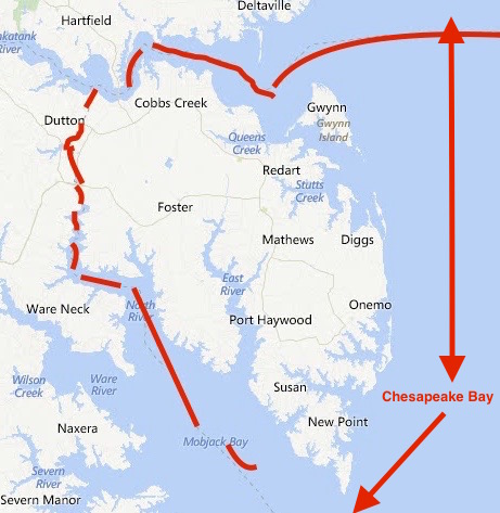
Image Courtesy of FEMA Region III (red notes showing Mathews’ area added)

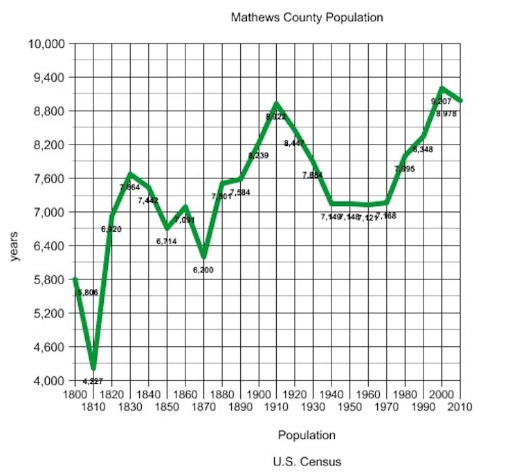
The plan’s presentation of the county’s population over the years is at odds with reality.

Mathews County’s population changed little between 1840 and 1900. The population peaked in 1910 with 8,922 residents, but gradually declined over the next five decades to a low point of 7,121 in 1960. This was in keeping with a national trend of population shifts from rural to urban areas because of the increased job opportunities in the cities. The population began to grow in the 1970’s and it took until the mid 1990’s before the population reached the peak reported in 1910.

An actual graph paints a different story. After every decline in population, there’s been an upward trend. Mathews will never be an urban area, nor would most of its residents want it to be. What’s MPPDC’s purpose in distorting the description of the population pattern?

Mathews Population from U.S. Censusu 1800-2010

MPPDC’s lapses in accuracy continue on page 75 of the All Hazards Plan under Ditch Flooding Vulnerability.

Throughout the Middle Peninsula of Virginia, the network of aging roadside ditches and outfalls, serving 670 miles of roads, creates the region’s primary stormwater conveyance system.

Arithmetic is a weak point for the Middle Peninsula Planning District Commission. According to VDOT statistics, the six counties involved in this regional plan have 279 miles of primary roads and 1,358 miles of secondary roads between them. Even if I didn’t have an educated pencil, my computer says that’s 1637 miles. My Echo Alexa agrees.

Currently each locality in the region experiences inadequate drainage and as a result, roads and private properties are frequently flooded after a storm event. The lowest lying localities (ie. Mathews and Gloucester County) are more vulnerable to ditch flooding as most of their land is either at or slightly above sea level.

Mathews is part of two watersheds and seven subwatersheds all existing so rainfall not absorbed by the land can reach the rivers and Chesapeake Bay. An extensive complex of streams follows the topography which consists of gentle contours from about 3 feet in the southern salt marshes to 35 feet in the northwestern region.

“At or slightly above sea level”? No wonder MPPDC thinks a foot and a half of sea level rise will wipe out a third of Mathews.

Watch for the next installment of Accuracy Not Guaranteed when the error catalog of the Middle Peninsula All Hazards Mitigation Plan continues.

Beneath the Surface

The Chesapeake Bay Impact Crater’s central area is about 56 miles (90km) across, making it the largest in the United States and the 6th largest in the world.  To give you an idea of what the crater would look like if it weren’t under the Bay and filled with marine sediments, take a look at this photo of the Barringer Crater in Arizona, about 600 ft deep and 4,000 ft in diameter. (Image Courtesy: Michael Collier; Image source: Earth Science World Image Bank, Copyright Michael Collier. http://www.earthscienceworld.org/image)         

(Landsat photo courtesy of U.S. Geological Survey)

Our Chesapeake Bay Impact Crater kept its identity a secret for a good bit of its 35 million year existence. Some material was vaporized when the bolide struck; some was thrown into the air and fell back in a jumble; some was melted and flung into the air, falling as glassy blobs called tektites as far away as Georgia and Texas. Over the eons, marine sediments filled in part of the crater and disguised its origin.

But it was the discovery of “shocked” quartz in undersea core samples off the New Jersey coast that led C.Wylie Poag, chief scientist on the Glomar Challenger, to search for the impact area. There’s a great article at http://meteor.pwnet.org/impact_event/impact_crater.htm with excellent photographs and explanations.

So now you know about what’s under Mathews County. In the next post, I’m going to start talking about some of our special places and things happening in Mathews.

CJ

The Crater Rim–Hiding in Plain Sight

Driving through Mathews towards Gloucester Courthouse, when woods don’t obscure the view, you can see that the slope of the land is relatively flat.

As you approach Main Street in Gloucester though, there is an unexpected sharp rise.

Very high compared to the surrounding areas, but not that impressive–until you learn this is the very top of the wall of the Chesapeake Bay Crater rim which extends down somewhere between 1,000 and 4,000 feet.  Now that’s impressive.