New Point Comfort Development Company’s Plans: A Mathews Resort – But Only On Paper

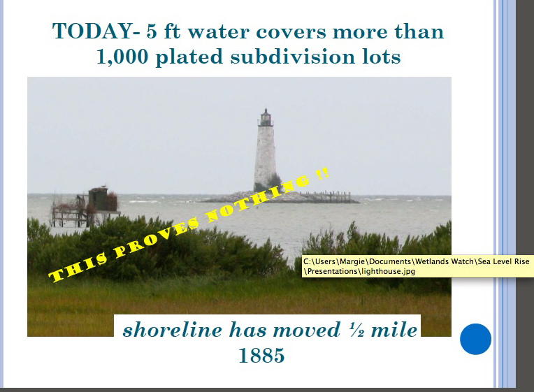
The last post showed this Wetlands Watch slide used in a Middle Peninsula Planning District Commission presentation.

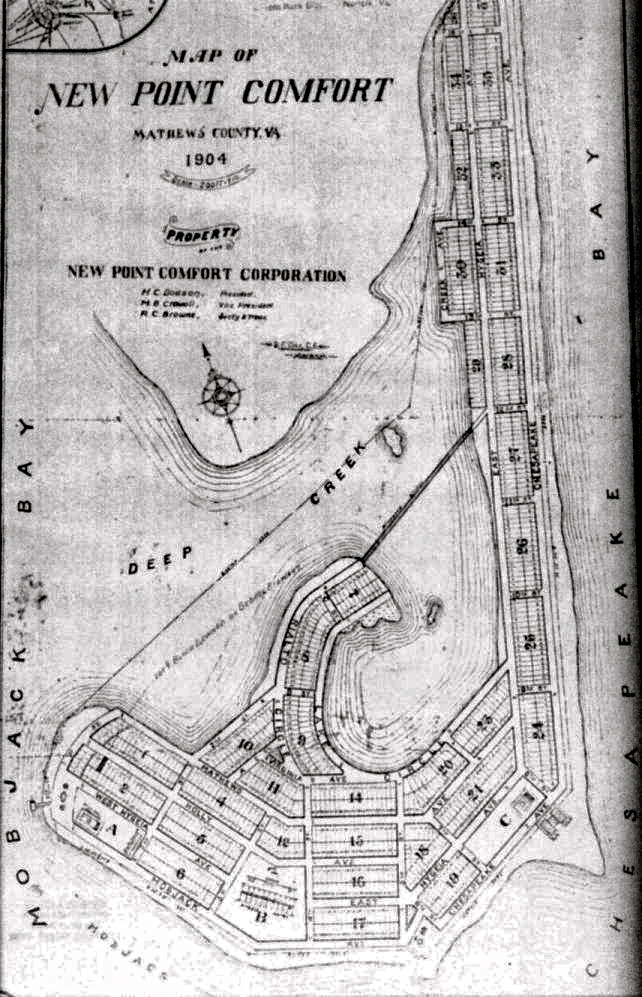
It’s true you’ll find water and some marshes today where the lots were shown on a 1904 Mathews County subdivision map near the lighthouse. But what the MPPDC/Wetlands Watch slide doesn’t say is the development company planned to fill in the tidal marshes and bring in sand to create beaches. The New Point Comfort Lighthouse site online says that the enormous cost to carry out that plan is what caused the company to go out of business the following year.

New Point Comfort Development Company Subdivision Plan – 1904


So what happened to the tidal marshes, sandbars and shoaled areas that existed in 1904 and earlier? And what about the photos and stories of people a generation or two ago who went to sandy beaches at New Point for picnics and outings?

Sand moves with the wind and waves. It is washed away, and bars and beaches reform at another place if there’s enough material available. But major storms can play havoc with that process. The Office of Naval Research describes one kind of current along the coast called the Longshore Current, how it moves, and how it can cause powerful and dangerous rip currents.

There’s an animation of the wave action that can produce sandbars on ONR’s educational Science and Technology Focus website at: http://www.onr.navy.mil/focus/ocean/motion/currents2.htm

With hurricanes and some other storms, the low pressure system increases the speed of longshore currents and height of waves. When these stronger longshore currents produce rip currents, they excavate channels through sandbars. The sand then accumulates in a quieter areas forming new bars. In this way, depending on the number and types of storms, and the intervals between storms, sandbars appear to migrate. When sand is exposed and dry, the wind then moves it to build up beaches–or blow them away. Beaches can only build up when dry sand is available. If the angle of a beach changes, so that the sand remains wet, the beach will not grow and can be diminished by wave action or the effects of storms.

The Chesapeake – Potomac Hurricane of August 23rd, 1933 and the one that hit on September 16th, 1933  ripped through the area around New Point Comfort, leaving two separate islands we see today. But the New Point Comfort Lighthouse withstood the tremendous winds and rain and waves, and isn’t that the story that really matters?

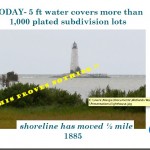
 

The Shoreline’s Moved 1/2 Mile–if Sandbars Count as Shoreline

The shoreline that moved was mostly sandbars washed away by storms and waves.

This slide was used in a Middle Peninsula Planning District presentation at a  Virginia Coastal Partners Workshop in 2010.  An eye-catching headline, a dramatic image, a subhead intended to reinforce an idea. Wetlands Watch supplied MPPDC with the image, and both organizations used the same picture in separate presentations at the same workshop.

Wetlands Watch used the line, “Climate Change Impacts Can be Seen in Virginia” along with “From 1885 to now–the shoreline has moved 1/2 mile.” The banner across the center of the MPPDC slide says: “THIS PROVES NOTHING!!” To which I can definitely say, You’re right!  This doesn’t prove any sea level rise; it doesn’t prove climate change; and there’s a lot more to this story.

Virginia Institute of Marine Science (VIMS) did a site assessment of the New Point Comfort Lighthouse in 2008, and they noted that “erosion has always been an issue at the New Point Comfort.” The lighthouse was built on a peninsula connected to the mainland by a sandbar. Between the time the lighthouse was built in 1804 and 1832, immense areas of sand had been moved by storms, waves and wind. What follows here is the story of what was done to try to protect the lighthouse during those years, not from rising water levels, but from the relentless scouring of sand from the lighthouse island by waves and wind and storms.

The keeper reported after the Great Coastal Hurricane of 1806 that “a considerable part of the beach washed away & one of the landmarks <indicating the boundaries> was washed up, that was at the distance of 45 feet, when the public land was laid out from highwater mark.”(Candace Clifford, New Point Comfort Light Station – Historical Documentation, 2001) “This hurricane, due to its slow movement and consequent erosion of the coastline completed the formation of Willoughby Spit. A seawall built to prevent further erosion at Smith Point Lighthouse was damaged.” (http://www.hpc.ncep.noaa.gov/research/roth/vaerly19hur.htm)

In 1814, the first report of the extensive damage the British did to the lighthouse in the War of 1812 suggested the lighthouse should be destroyed if the war continued because it was being used as a watchtower, and “the water already washes its base and in a few years will undermine it.” (Clifford, 2001 quoting from the National Archives.) That advice was not followed and in 1815, the original builder recommended 156 pilings of 12-14 ft be sunk 5-6 ft in the sand, and another 100 opposite the house to protect it.

A year later, sand had begun to collect around the pilings and the lighthouse was considered secure. Unfortunately, by 1822, those pilings had rotted in the ground. A stone wall was then approved in 1825, and still more repairs and additional work were done in 1832.

The National Archives holds a request for a boat in 1839 because, “There is now two miles of water communication necessary where until lately there was a ford at low tide.”  In 1846, the keeper reported the “publick buildings were completely surrounded by tidewater.” (Candace Clifford, 2001)

The lighthouse was put out of commission during the War Between the States in 1861, restored in 1865, and once again, a boat was requested for the keeper in 1866. Sand moved and shoals formed in the decades that followed, and gales and hurricanes moved and changed them as they always have. But that’s a function of weather, normal, ordinary weather–capricious and unpredictable, not because of climate change.

The next post will take a look at what happened to the 1904 1,000 lot subdivision of the New Point Comfort Development Company. Or, perhaps more accurately, what didn’t happen.

*   *   *

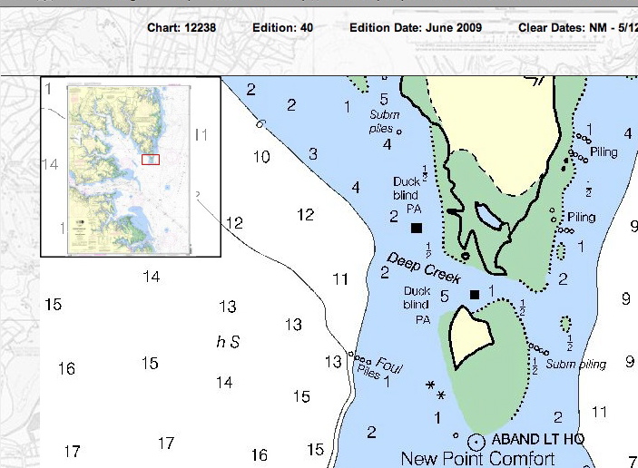
Below is a detail from NOAA Nautical Chart 12238, showing water depth in feet in 2009 around New Point Comfort Lighthouse island. (Green areas are marshes.) One small area to the northwest, between the lighthouse and the shoreline is 5 ft as the MPPDC/Wetlands Watch slide said, but north, past a marshy area, it’s 1 ft; to the northeast, 1/2 ft, and east-northeast, 2 ft.


The New Point Comfort Lighthouse

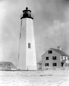
New Point Comfort Lighthouse, date unknown, possibly late 1800’s


The New Point Comfort Lighthouse is on an island off the southern tip of Mathews County. It’s the 3rd oldest lighthouse surviving in the Bay, the 10th oldest in the Country, and it’s on the National Register of Historic Places. Efforts are underway to preserve it for the future. (Photo courtesy of the U.S. Coast Guard and the National Archives.)

There’s a great video and a lot of information here: http://www.newpointcomfortlighthouse.org/

There’s also a concise and well-written history on the Lighthouse Digest site:  http://www.lhdigest.com/Digest/StoryPage.cfm?StoryKey=2304

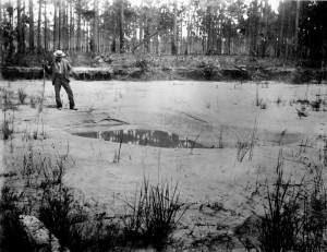
Photo on Ten Mile Hill shows the effect of liquifaction where the intense shaking caused the water to rise and mix with the sand, forming a craterlet with puddled water at the bottom after the shaking stopped.

The lighthouse was completed in 1804, and has survived a number of storms, the War of 1812, and the Charleston Earthquake of August 31, 1886, which shook seven states from South Carolina to New York. Aftershocks  continued for days afterwards, but the lighthouse withstood them all.

(Photo courtesy of U.S. Geological Survey; Photo by C.C. Jones, September 1886. Plate 20, U.S. Geological Survey Annual Report 9, 1887-88)

Currently, the lighthouse is being used as an example of the imminent danger from sea level rise caused by global warming. My next post is going to show why that’s not quite the case.