By G. C. Morrow
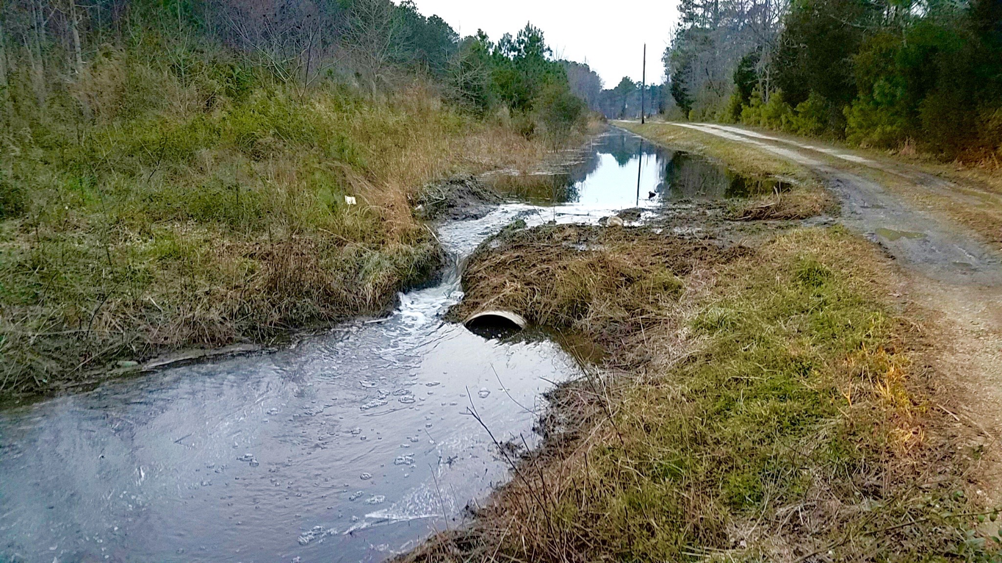
Wards Corner Outfall Beaver Dam
I decided to look at previous projects to see if I could find a pattern in their failures. It is extremely hard to conceive that these projects with their half million plus engineering budgets fail so miserably at their purpose. At first glance, it appears that the engineers are attempting to move their drainage conveyances to more accessible locations, but even the greenest of engineers should know better than to try to drain water uphill. (G. C. Morrow, June 15, 2016)http://insidethecrater.com/714-2
Most of the environmental and pollution problems we are facing in stormwater management can be traced to very simple explanations and solutions. I warned in 2016, “South of Wards Corner, there are three outfalls much lower in elevation than the one at Wards Corner, and they are necessary to handle several hundred acres of stream flow, as well as roadside drainage.”
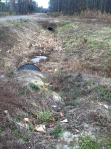
Beavers are drawn to the sound of water whose flow is disrupted. They have invaded the Wards Corner outfall, as well as two unmaintained neighboring outfalls.
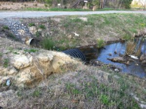
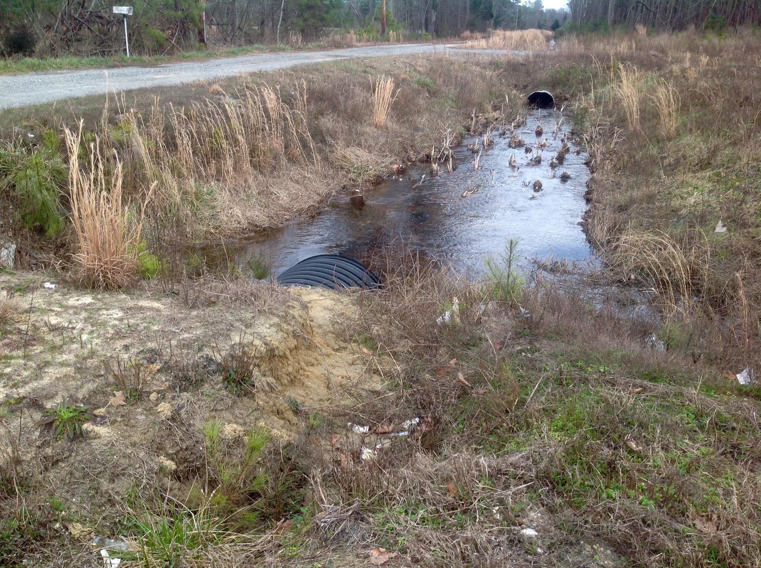
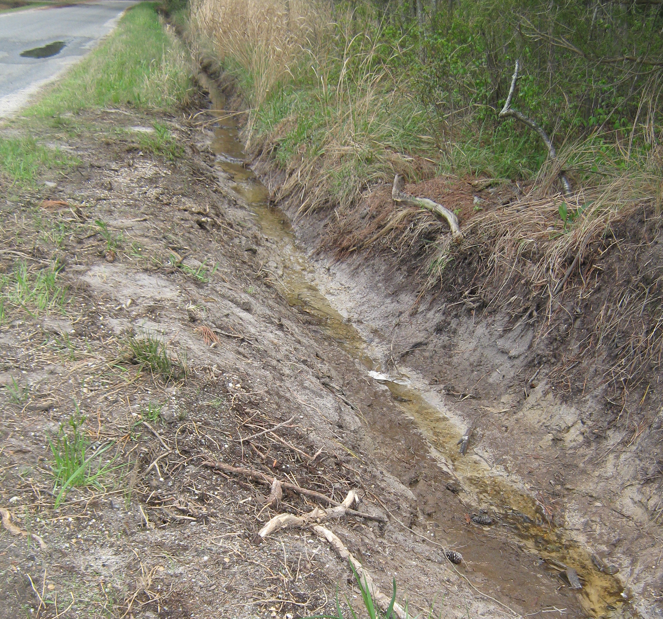
I saw three dams at Wards Corner this week. At one place, the dam filled the outfall to the top, about 6-8 feet deep. Water was overflowing next to a 36-inch pipe and cut through the earth surrounding the pipe to create a spillway. This eroded soil is going downstream into the marsh.
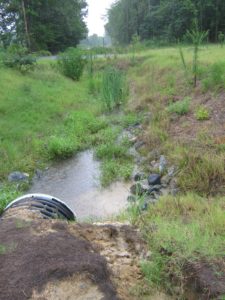
Similar erosion has occurred around the 36-inch pipe at the start of the outfall off the shoulder of route 198. Old-fashioned concrete endwalls would have prevented the erosion at both locations, but today, only cosmetic plastic endwalls are used–and this project didn’t even use those.
We won’t know until the dams are cleared exactly how the beavers managed to block the flow so well. If the outfall had functioned properly, draining within 2-3 days after rainfall, there shouldn’t have been enough water to attract beavers in the first place, especially since the outfall is uphill of most of the area it’s supposed to drain.
A large number of saplings, stripped of their bark, are lined up on the banks near the dam, ready to be used to enlarge or repair it. The beavers will continue to stop the water as long as it’s moving slowly enough for them to harness it to float the saplings into place.
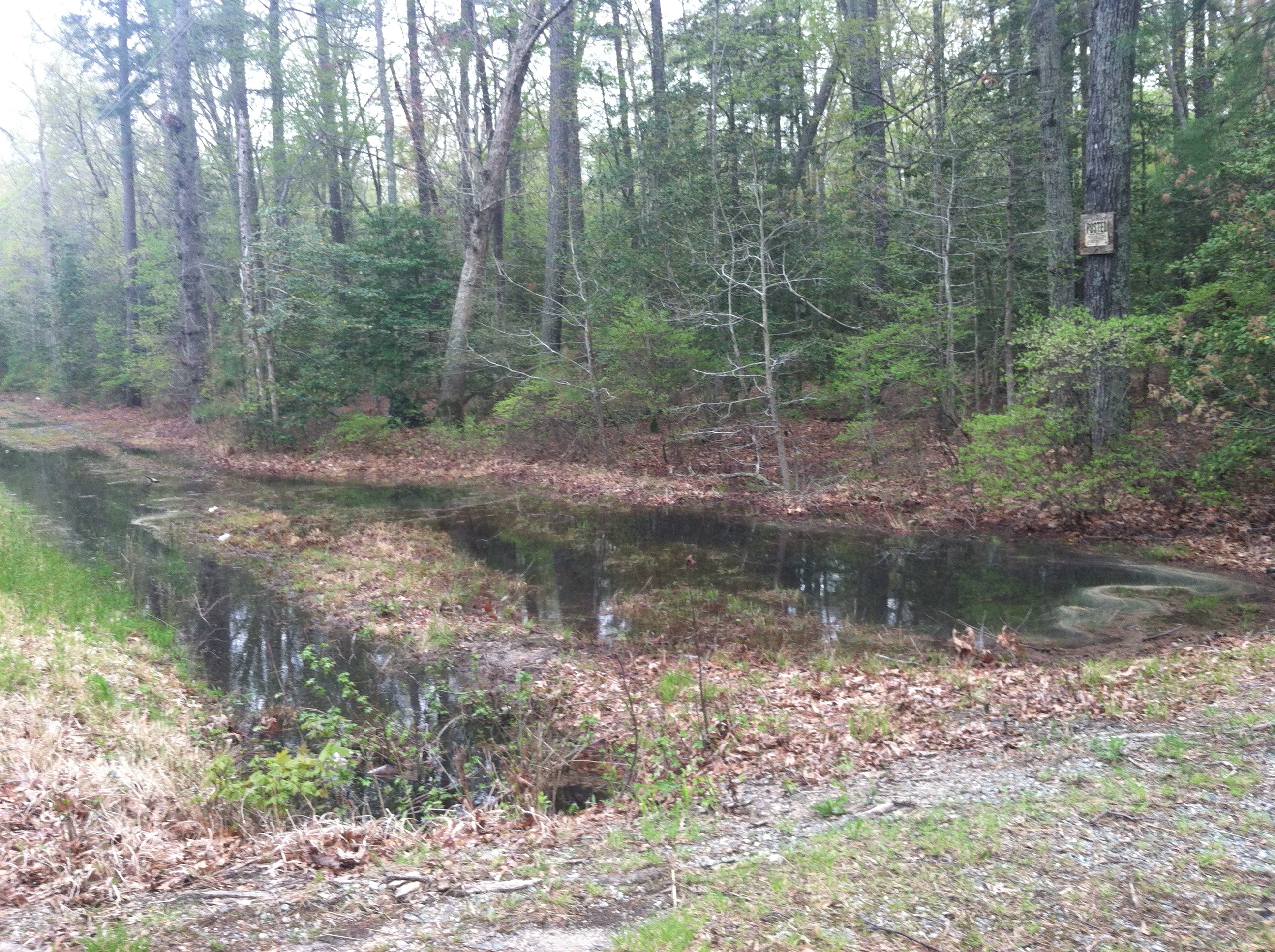
It appears that using rock checkdams to slow down the water flow in a rural environment is not the right answer. Putting the drainage in the right place might have been a better idea.
Makes you wonder why the state spent $1.6 million to cause perpetual flooding of downstream locations. A much smaller amount could have restored the outfall to Stutts Creek behind the high school, and cleared or even replaced the pipes in the VDOT easement along the football field. Doing that would have conveyed the water from Route 198 to the creek and not let it flood the school and park properties. Now, the county is being asked to fund half the cost of the restoration through revenue sharing or continue to suffer the damage of its property. It may be that VDOT’s failure to maintain an outfall inventory meant the designers didn’t know about the existing outfalls.
At some point, VDOT designers and engineers have to use real world considerations and get away from their laptop configurations. Overbuilding to create a new construction project, instead of developing a simpler restoration of existing structures, is not a better value-based decision in the long run, even if federal money is involved. And that era may be ending soon.
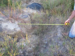
The following pictures are taken at the shoulder on Route 198 looking toward the area with the beaver dam showing the progressive erosion.
Wards Corner 2012
2013–eroded area 4-feet wide
2014
2015
2016


