Don’t Like the Weather? Wait a Few Minutes.

Winter isn’t letting go of us this St. Patrick’s Day. We’ve had rain, sleet and snow here in Mathews, and it’s down to 27, but the sky is quiet for now. Our writing critique group meets in Williamsburg, and so the question is: how are the roads?3-17-14 blog traffic cam

I dialed 511 for road information. It used to be a pretty straightforward call, if you were in a quiet enough place for the voice-activated computer to understand you. If not, you could pull over and use the keypad. Well, the 511 system has been improved, effective November 20th, some menu options have changed, please listen carefully, as the recording tells us. I asked for 17, and it gave me the Hampton Roads Bridge Tunnel.

Second try: “Say the name of an interstate, bridge or tunnel.”

U.S. 17  This time I opted for the keypad, and 17# got me a series of options, but nothing familiar. Hampton Roads seemed the most reasonable of the choices. (I used to be good at multiple choice answers, but guess not any more.) I apologized to the human who answered because she couldn’t help me with US Route 17.

Third try: Before I spoke, the system interpreted some sound as a request for tourism information, and I couldn’t get it to start over, go back, (go to) menu, and I ran out of ideas to try while it wanted me to pick a tourism location.

Fourth try: Not sure how it happened, but I got I-81.

Fifth try: It gave me US Route 7.

Sixth try: I got ride share information. (Usually done by hitting 4 on the keypad twice, which I hadn’t pressed.)

Seventh try: I got  U.S. Route 7 again, and tried to use the keypad to go back. No luck. “After many tries, the system has not received a valid response.”  Neither have I.

Just because I’ve invested this much energy already, I want my road information, and I want to know how to get an answer out of this system. Now this isn’t a case of road noise. I’m in the house. I used to be able to get an answer, so what am I doing wrong on this new, improved system? I need to know whether to stay or go.

Eighth try: Got it! It told me, “Select your direction of travel.” Progress! Then a selection from Winchester to Route 66; 66 to Fredericksburg, Fredericksburg to Yorktown… And we get off at my stop!

I hear about tomorrow’s bridge opening. Good to know. Then a report of icy conditions between the Junction of US 1 and US 2.

Huh? I don’t even know where they are, but they’re not in Gloucester. I go online and find 511Virginia.org.

I check the traffic cameras on the Coleman Bridge. Nobody’s skidding, but they seem to be going way too fast for the weather. I click on the scrolling banner, “Get the Latest Road Conditions.” Mathews is clear; Gloucester is clear; York County and the Coleman Bridge have minor icy patches. Don’t know where to look for Williamsburg, but it’s decision time. Leave now or call and cancel. One more look at the bridge cams, and I leave.3-14-14 blog cam 2

Takes a few minutes to get the icy snow off the windshield, but I’m just about to pull out when my phone rings. The group’s off for tonight because others have cancelled, and I can’t be sure I’ll be able to make it either.   (Bless you all!)

Celebrating my relief, I get a rotisserie chicken from the market and settle in front of the computer. The 511virginia.org page is still up on the monitor where conditions on the bridge have gone from minor patches to Icy Conditions with an advisory.  Since I first walked out the door, the Doppler radar weather map has colored the whole area from here to Williamsburg and further in shades of frozen pink.

I don’t know if my guardian angel stepped in to rescue my foolish self, or if I’d have had the sense to know things were bad and cancel out half-way, but I’m home safe. Just have to remind myself next wintry mix time of the Mathews weather slogan: Don’t like the weather? Wait 15 minutes and it’ll change. I forgot that doesn’t always mean for the better.

But spring will be here in a couple of days. I saw fat daffodil buds ready to prove it when I drove in tonight, and that’s one change I’ll be happy to wait for.

Springing Forward

Inside the Crater went silent a year ago, but life kept on moving ahead, dragging and pushing me along too. With the time change this morning to move ahead an hour for Daylight Savings Time, I thought this would be a good time to reactivate Inside the Crater.

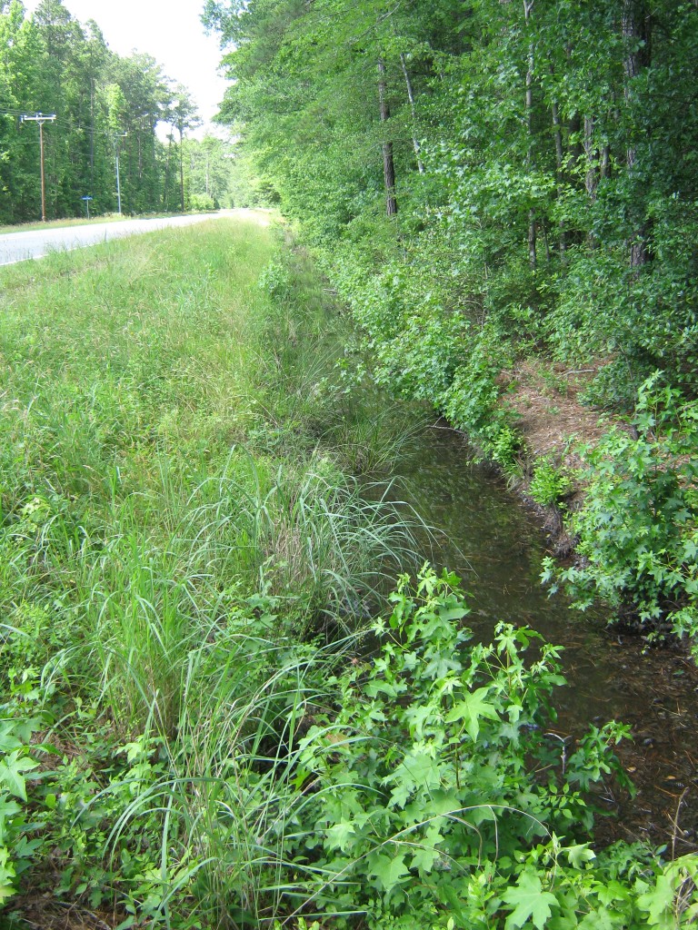
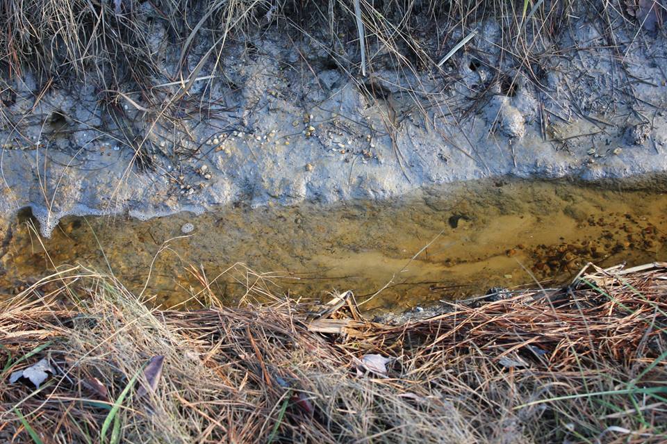
VDOT finished a part of the Canoe Yard Trail outfall and roadside ditch last year, so the rainfall runs crystal clear to the marsh now.

1545092_571497736259832_880957770_n

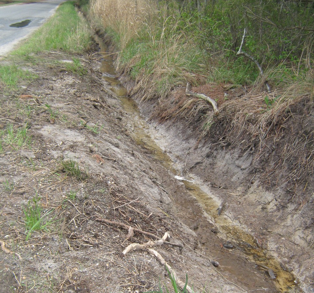
This is our one shining success story for the Ditches of Mathews County Project, even if it’s incomplete, but we’ll accept it with thanks. It proves what we’ve said all along: if the roadside and outfall ditches are cleaned, have the proper grade and the pipes are open–Mathews has no trouble draining its stormwater, even in Onemo with its low elevation.

The EPA approved our TMDL Implementation Plan to improve the water quality in the Piankatank/Milford Haven/Gwynn’s Island watershed, but the Ditch Maintenance Task Force recommendation still needs to be organized. It’s on my list, after I finish my book, Drowning a County.

Drowning a County traces the history of highway drainage in Mathews County and the institutional myths the Virginia Department of Transportation’s used to explain away their failure to maintain their systems for decades. The book debunks those myths with published mainstream scientific information, translated into normal English.

To do this, I tracked down Army Corps of Engineers hurricane surveys from the 1950’s and 60’s and a 1980 drainage study of the Garden Creek watershed. I learned a lot about Mathews County in reading through 34 years of Board of Supervisors minutes about ditches and VDOT and the revenue-sharing for ditches saga from 1993 to 2008.

Wetlands ecology wasn’t on my reading list, but turned out to be an essential element, aided by the Mathews Memorial Library’s acquisition of an excellent textbook.

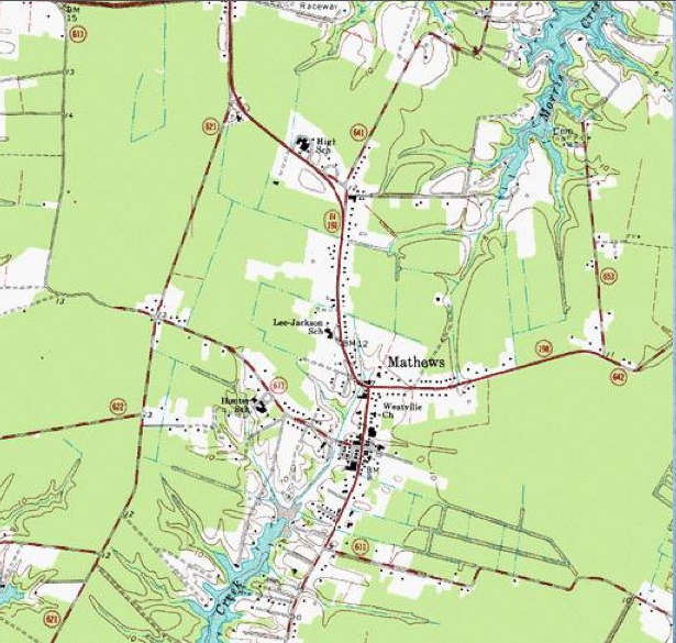
GC Morrow taught me how to find overgrown outfall ditches and probe for pipes under the road that could no longer be seen and how to use topo maps to track the streams channelized as outfalls.

Blue dashed lines were drainage structures and streams in 1965–some of which are now totally obstructed. Image courtesy of USGS from Mathews topo map

Can’t count how many wonderful Mathews residents stopped to see if I needed help while photographing ditches from the roadside. And that is probably the biggest factor in why I kept going on this project: the people of Mathews. They are good people with a long history here. They’ve kept the environment in such good condition that if the ditches could drain to the appropriate creeks and rivers and carry fresh rainwater, nature could solve a lot of the E. coli problem the TMDL plan addresses.

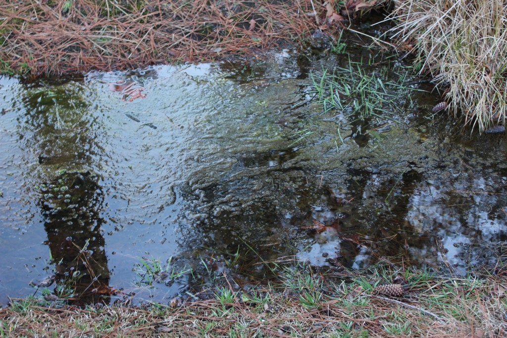
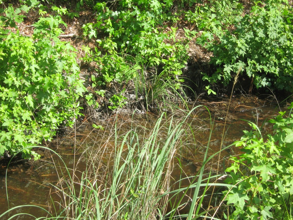
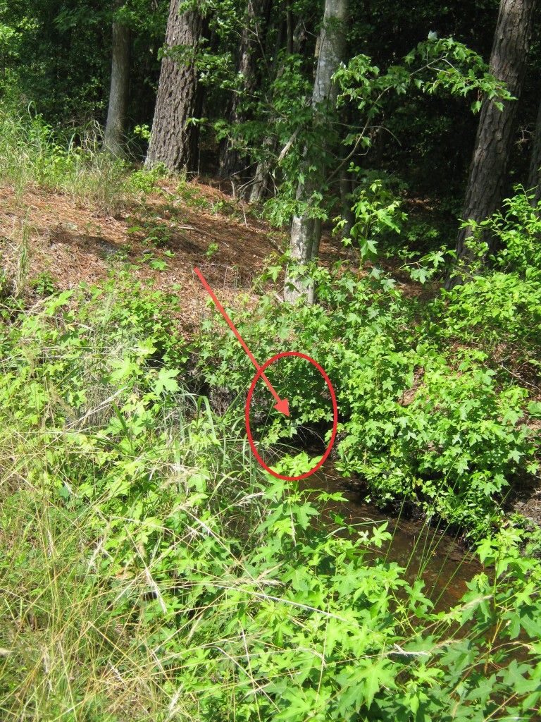
But VDOT mythology turned highway ditches into retention ponds filled with muck and algae and stagnant water.

Algae in flooded ditch with blocked pipe

This spring, VDOT just might realize their mythology has kept the roadbeds saturated and caused more freeze damage  to the roads this winter than they ever imagined.

For me, I’ve made it through the winter and over the despair of feeling I’d taken on an impossible task. Spring is on the way, and Drowning a County is on the way to completion too.

Check out Carol’s Ditches of Mathews County columns at http://ChesapeakeStyle.com.


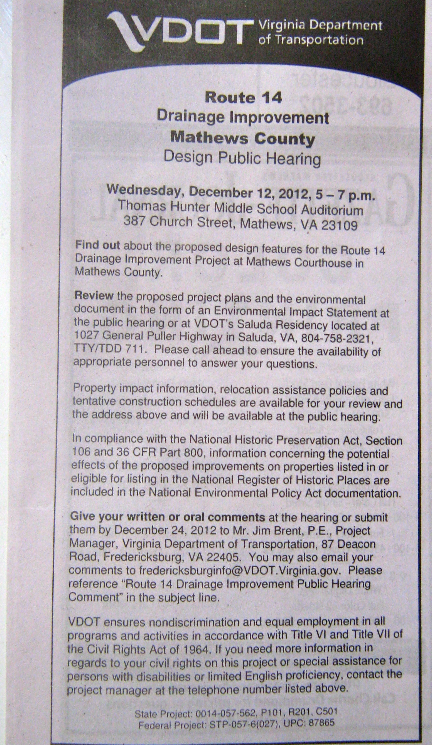
MAIN STREET DRAINAGE IMPROVEMENT

DESIGN PUBLIC HEARING

DECEMBER 12, 2012

5-7 PM THOMAS HUNTER MIDDLE SCHOOL

Public Meeting notice in Gazette Journal 11/15/12

The meeting will only cover Main Street drainage from Hyco Corner to Kingston Parish Hall, and comments will be limited to that area.

Wondering why now? Why no mention at the October board meeting? Why no documents are available for inspection in Mathews?

The Ditches of Mathews County

Route 611/Church Street in Mathews looking towards Rt. 14

The latest picture story on Facebook by The Ditches of Mathews County shows a small section of Church St/Route 611 going from Mathews Courthouse towards Rt. 14. Wish I could say this level of vegetation is an unusual situation, but it’s becoming the norm with the reduction in VDOT mowing cycles as a cost-saving measure. The question then becomes: How much is this going to cost in the long run when so many cross pipes are blocked?  Each blocked ditch section becomes a mini-lake and young trees and marsh grasses and weeds in general are flourishing undisturbed.

TMDLs? Mathews Residents Need To Figure Out How to Play This Numbers Game on May 23, 2012

I don’t think you can find anyone who will say they want dirty, fecal-contaminated water in their rivers, creeks and bays. But there are no easy answers for how to clean them up, or even how to guess how many potential sources there are. Yes, I said guess, because most of the reporting comes from computer modeling based on computer generated land use maps. Short of going out and counting every dog, raccoon, deer and duck, the best we can do is an educated guess.

<<JUST IN: IMPLEMENTATION PLAN SIMILAR TO WHAT WE CAN EXPECT:Greenvale Creek Implementation Plan>>

But we can apply common sense and general knowledge to refine those computer models. We’re on a deadline here: a public meeting has been called for May 23rd at the YMCA in Hartfield, 6:30 – 8:30 pm, for Mathews, Middlesex and Gloucester residents.   DCR Meeting Notice 5-23   It’s up to us to show up and share what we know. We need to question what doesn’t make sense in the old reports too — before the same information is passed along to the plans that will follow this meeting.

Shellfish Factsheet What we know right now is the Department of Environmental Quality defines TMDLs (Total Maximum Daily Load) as “the total pollutant a water body can assimilate and still meet standards.” And there are 9 creeks feeding into the Gwynn’s Island/Milford Haven Watershed or Piankatank River and parts of the Piankatank that are impaired and have levels of fecal coliform bacteria that are too high for growing shellfish.

If more information turns up, I’ll add to this post. Links to the old reports follow, with maps that show the areas involved.  See you at the meeting on the 23rd!

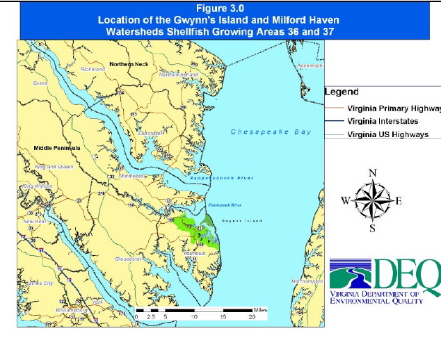
The impaired waters being discussed are located in these VA Dept of Health Shellfish Growing Areas

TMDL Report Gwynn’s Island and Milford Haven Watersheds

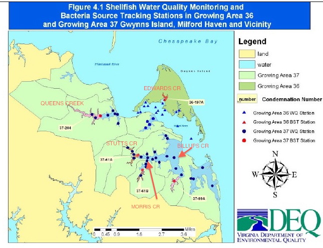
Gwynn’s Island and Milford Haven Watersheds shown in green

TMDL Lower Piankatank River

TMDL Modified Report Lower Piankatank River

TMDL Report Upper Piankatank River

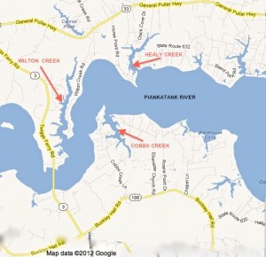
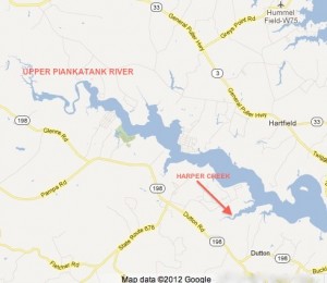
5 Creeks in Gwynn’s Island-Milford Haven Watershed With Impaired Shellfish Waters


Wilton, Healy and Cobbs Creeks

Upper Piankatank River and Harper Creek


Wetlands Plant Indicator Categories Changed — and so did the definitions

When I first wrote this story, I was excited that I received a helpful and rapid response from the U.S. Army Corps of Engineers within 3 hours of my emailed inquiry about the 2012 National Wetland Plant List:”Good timing with your message, the National Wetland Plant List (NWPL) has been finalized and a notice was published in the Federal Register today [May 9, 2012]… https://www.federalregister.gov/articles/2012/05/09/2012-11176/publication-of-the-final-national-wetland-plant-list.  The NWPL officially becomes effective on 01 June 2012.”

Loblolly pines are a familiar sight in Mathews

The 2012 National Wetland Plant List shows Pinus taeda (loblolly pine), and   Liquidambar styraciflua (Sweet Gum) as FAC.  FAC used to mean Facultative, equally likely to occur in wetlands or uplands.  I thought that with the new list recognizing plants like loblolly pine and honeysuckle as very adaptable and not limited to wetlands, the same idea would be carried through in the rest of the listings–and future wetlands delineation decisions would be more rational than in the past.

But not only did the panel add 1,472 plants to the original 6,728 species, they changed the definitions of their wetland indicator classifications as well.

OLD OBL – Obligate Wetland: Occurs almost always (estimated probablility 99%) under natural conditions in wetlands.
2012 OBL: Plants that always occur in standing water or in saturated soils

OLD FACW – Facultative Wetland: Usually occurs in wetlands (estimated 67% – 99%), but occasionally found in non-wetlands
2012 FACW: Plants that nearly always occur in areas of prolonged flooding or require standing water or saturated soils but may, on rare occasions, occur in nonwetlands

OLD FAC – Facultative: Equally likely to occur in wetlands or nonwetlands (estimated probability 34%-66%)
2012 FAC: Plants that occur in a variety of habitats, including wetland and mesic to xeric nonwetland habitats but often occur in standing water or saturated soils

OLD FACU – Facultative Upland: Usually occurs in nonwetlands (estimated probability 67-99%), but occasionally found on wetlands (estimated probability 1%-33%)                       
2012 FACU: Plants that typically occur in xeric or mesic nonwetland habitats but may frequently occur in standing water or saturated soils

OLD UPL – Upland: Occurs in wetlands in another region, but occurs almost always (estimated probability 99%), under natural conditions in nonwetlands in the regions specified. If a species does not occur in wetlands in any region, it’s not  on the National list.
2012 UPL: Plants that almost never occur in water or saturated soils

If the new FAC had stayed with “equally likely to occur in wetlands or nonwetlands,” we’d be in good shape. As it is, future delineations are probably going to be wetlands-biased, especially when FACU includes plants that grow in xeric (arid) regions, but also in standing water or saturated soils. They must be counting flash floods after storms to get that one in.

Take a few minutes and read the Federal Register entry. It provides some interesting background information on the comments from those on the reviewing panel who did not agree with the final decisions. Perhaps the planned challenge studies to test the new list will bring some adjustments. And when they set up the system again to search by county, it might be a good idea to download the local listings before visiting a nursery for landscape plants. Save those labels so you know the scientific names of whatever nonwetland plants you add to your plantings.

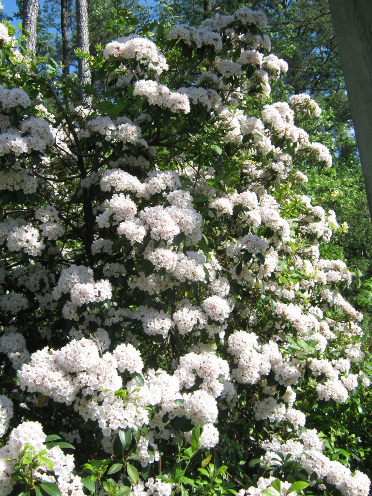
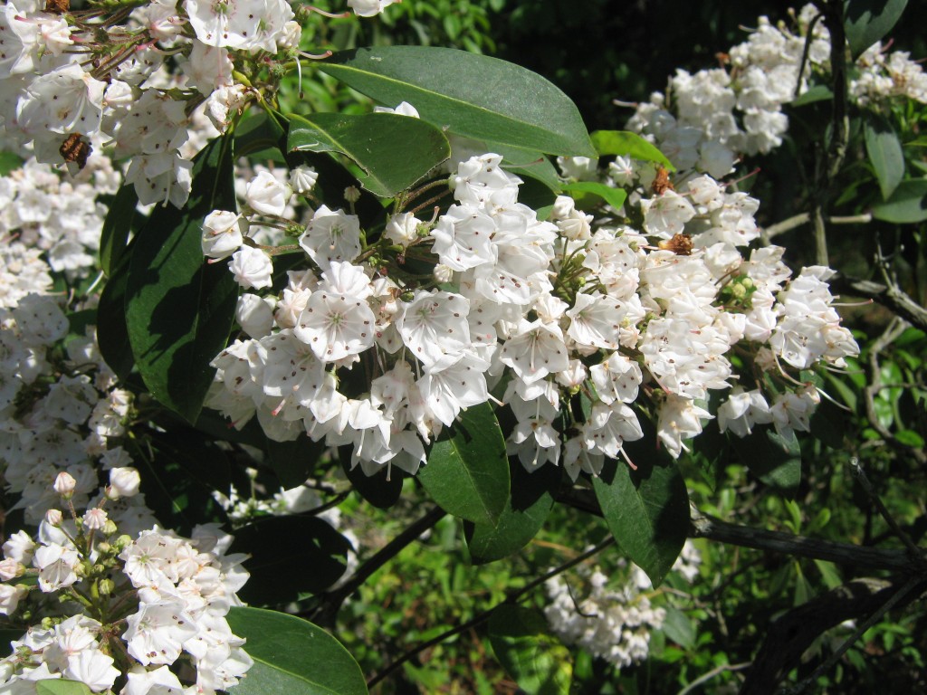
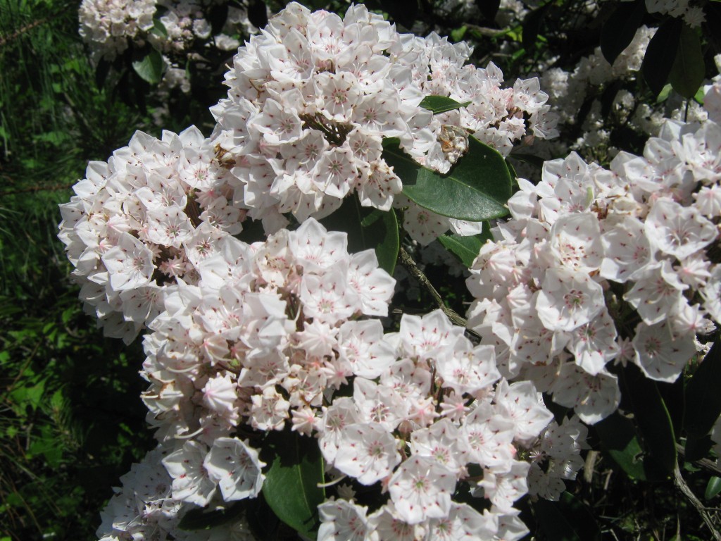
To leave you on a pleasant note, these are mountain laurel, Kalmia latifolia – FACU, growing in Mathews, and they aren’t in standing water or saturated soil.

Mountain Laurel (Kalmia Latifolia)  FACU

Mountain Laurel (Kalmia latifolia) FACU

Beneath the Surface

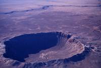
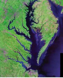
The Chesapeake Bay Impact Crater’s central area is about 56 miles (90km) across, making it the largest in the United States and the 6th largest in the world.  To give you an idea of what the crater would look like if it weren’t under the Bay and filled with marine sediments, take a look at this photo of the Barringer Crater in Arizona, about 600 ft deep and 4,000 ft in diameter. (Image Courtesy: Michael Collier; Image source: Earth Science World Image Bank, Copyright Michael Collier. http://www.earthscienceworld.org/image)         

(Landsat photo courtesy of U.S. Geological Survey)

Our Chesapeake Bay Impact Crater kept its identity a secret for a good bit of its 35 million year existence. Some material was vaporized when the bolide struck; some was thrown into the air and fell back in a jumble; some was melted and flung into the air, falling as glassy blobs called tektites as far away as Georgia and Texas. Over the eons, marine sediments filled in part of the crater and disguised its origin.

But it was the discovery of “shocked” quartz in undersea core samples off the New Jersey coast that led C.Wylie Poag, chief scientist on the Glomar Challenger, to search for the impact area. There’s a great article at http://meteor.pwnet.org/impact_event/impact_crater.htm with excellent photographs and explanations.

So now you know about what’s under Mathews County. In the next post, I’m going to start talking about some of our special places and things happening in Mathews.

CJ

The Crater Rim–Hiding in Plain Sight

Driving through Mathews towards Gloucester Courthouse, when woods don’t obscure the view, you can see that the slope of the land is relatively flat.

As you approach Main Street in Gloucester though, there is an unexpected sharp rise.

Very high compared to the surrounding areas, but not that impressive–until you learn this is the very top of the wall of the Chesapeake Bay Crater rim which extends down somewhere between 1,000 and 4,000 feet.  Now that’s impressive.


How did I land in an impact crater?

Even though I started out only 300 miles away, it took most of my life and a few cross-country trips to get to Mathews. On vacation in Virginia a few years ago, a friend from Alexandria suggested I go online and check out Rivah Country. I did and fell in love with the Deltaville website.

On my next trip to Virginia, I headed to Deltaville and drove down General Puller Highway enjoying the views of homes, shops, woods, marinas–all the way to Stingray Point. After another trip up and back, I realized Deltaville was not the town around a courthouse green that I’d imagined.

No mystery where this story ends: I found my way along Route 14 to Buckley Hall Road and then to Main Street in Mathews Courthouse. A stop at Mathews Art Gallery and the Bay School, a look in the library and a drive around the county…and it felt like coming home. It took several months more to arrange it, but I made it home here in 2004.