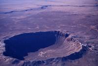
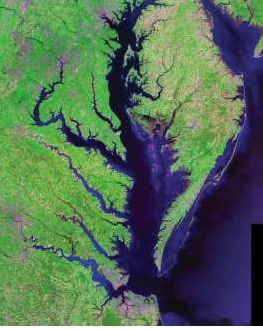
 The Chesapeake Bay Impact Crater’s central area is about 56 miles (90km) across, making it the largest in the United States and the 6th largest in the world. To give you an idea of what the crater would look like if it weren’t under the Bay and filled with marine sediments, take a look at this photo of the Barringer Crater in Arizona, about 600 ft deep and 4,000 ft in diameter. (Image Courtesy: Michael Collier; Image source: Earth Science World Image Bank, Copyright Michael Collier. http://www.earthscienceworld.org/image)
Our Chesapeake Bay Impact Crater kept its identity a secret for a good bit of its 35 million year existence. Some material was vaporized when the bolide struck; some was thrown into the air and fell back in a jumble; some was melted and flung into the air, falling as glassy blobs called tektites as far away as Georgia and Texas. Over the eons, marine sediments filled in part of the crater and disguised its origin.
But it was the discovery of “shocked” quartz in undersea core samples off the New Jersey coast that led C.Wylie Poag, chief scientist on the Glomar Challenger, to search for the impact area. There’s a great article at http://meteor.pwnet.org/impact_event/impact_crater.htm with excellent photographs and explanations.
So now you know about what’s under Mathews County. In the next post, I’m going to start talking about some of our special places and things happening in Mathews.
CJ

