The Mathews County Planning Commission is considering a list of “tools” MPPDC provided as ideas for a county whose goal is “living with the water.” The MPPDC (Middle Peninsula Planning District) suggestions for Mathews County’s comprehensive plan revision focus more on how not to develop the county’s land resources than any future use planning. There is a heavy emphasis on urban stormwater management which doesn’t fit our rural and relatively undeveloped county.
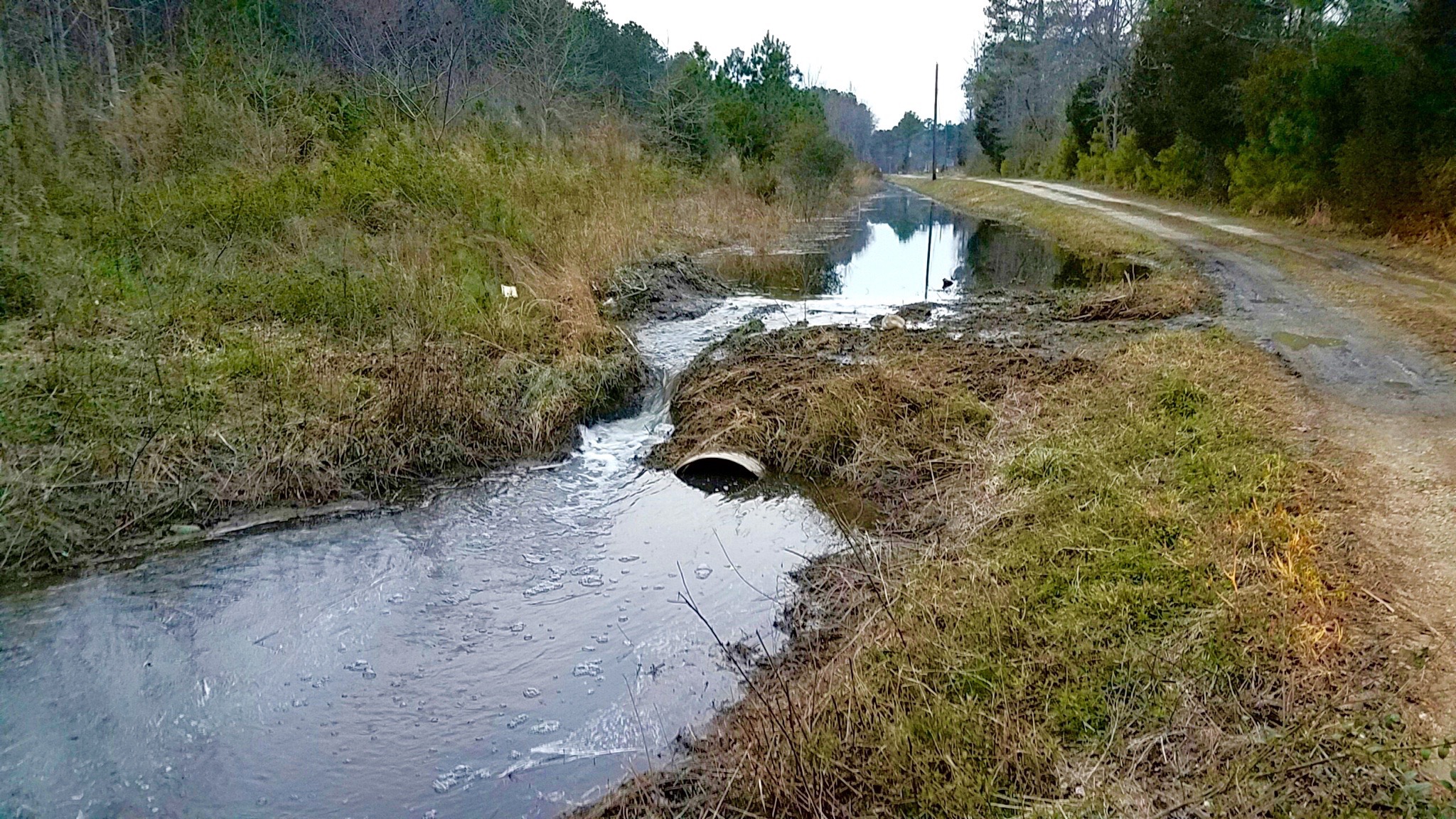
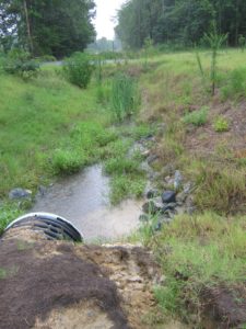
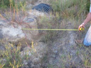
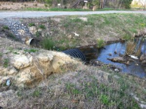
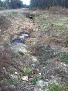
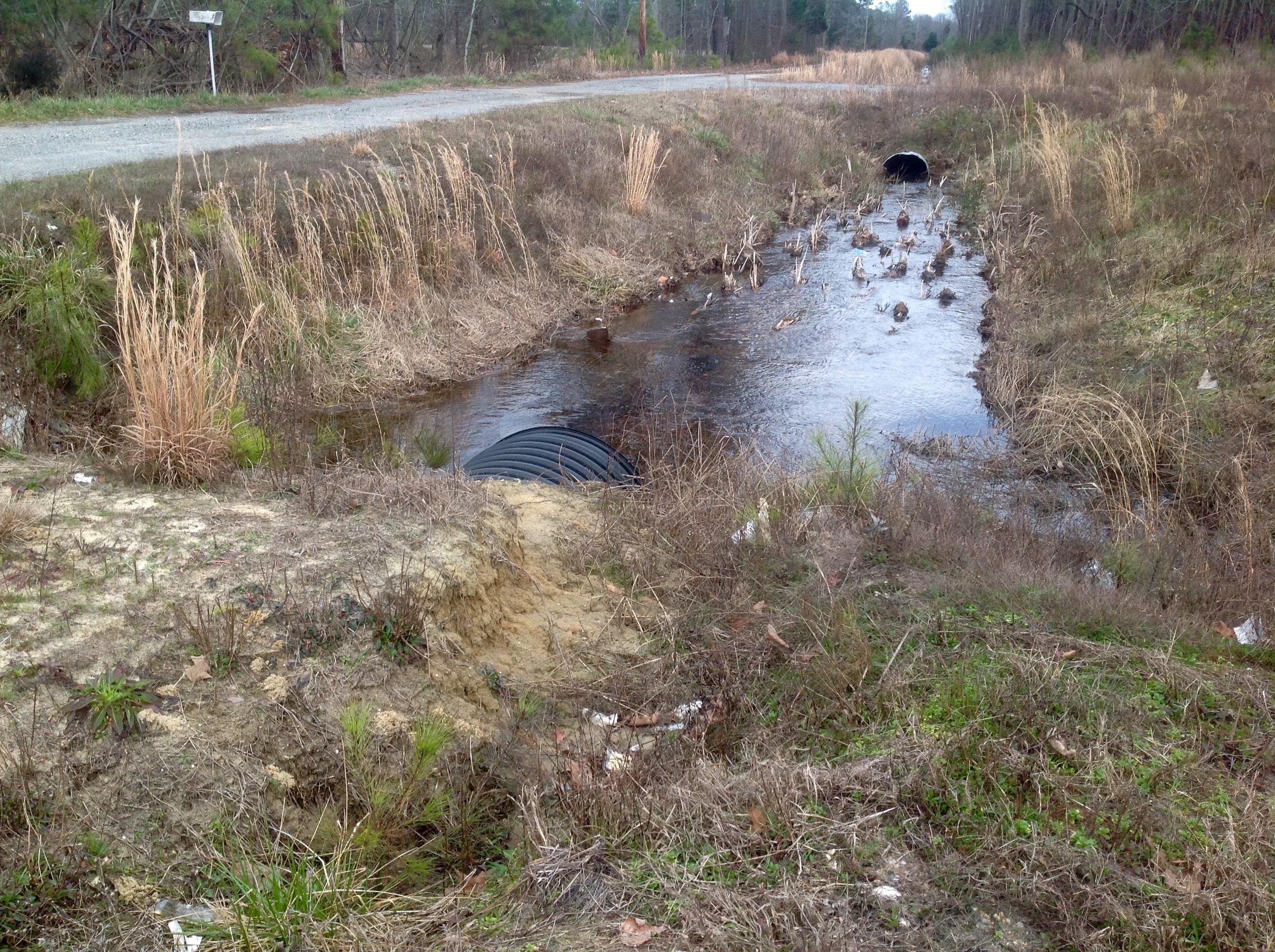
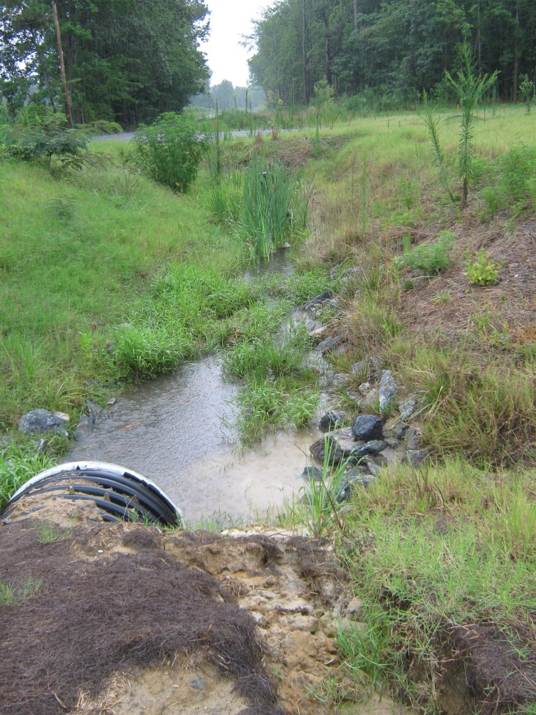
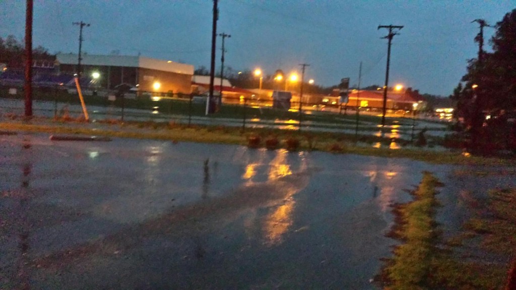
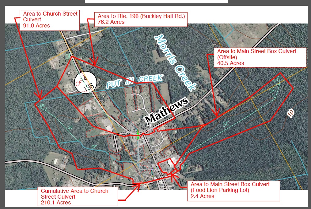
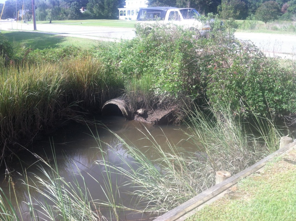
Our rural stormwater needs are centered on getting the Virginia Department of Transportation to fix its failing state road drainage systems that are flooding private property and woodlands. To their credit, VDOT seems to be hearing that message and is reaching out to partner with the county in working on the long-neglected problem. But there isn’t one word about VDOT’s drainage issues or the state’s responsibility in the “toolbox.”
The MPPDC tools do include the possibility of creating special hazard districts and Imposing new taxes and stormwater fees, and of course, the pet project of Executive Director Lewie Lawrence, the creation of a Ditching Authority. This would be a regional authority that would decide how much to tax landowners for the maintenance and repair of roadside and outfall ditches that cross their land across the Middle Peninsula. This Authority would act without the counties’ involvement or control if enabling legislation is created to permit its formation.
The basic idea ignores the fact that most of the roadside ditches are within the VDOT right-of-way, and where they’re not, there are easements for them, even though some of these were covered by consent of landowners, some dating back to the late 1800s. Others are included in right-of-way deeds as granting any land necessary “to construct, improve and maintain any drain ditches or other drainage facilities that may be needed for the proper and adequate drainage of said Route.” Also ignored is the fact is the number of outfalls that are natural streams that VDOT excavated. They are still considered streams by the Commonwealth, and landowners are not responsibile for their maintenance.
The MPPDC tools offer at least 11 ways to trade away Mathews land for cash payments or tax credits now that will prevent development here in Mathews forever. Some will allow urban developers to ignore an urban area’s zoning or environmental regulations and mitigate their violations by trading their building or ongoing pollution for unspoiled Mathews land. Transfer of development rights allows the urban over-development and eliminates ours. Polluters can keep polluting and substitute credits for locking in our land from development and paying us for the privilege. This doesn’t do anything to help the Bay. We’re already doing our part to help it recover, but the urban developers can continue to impair and damage it.
Conservation easements can be a good thing, but how do they fit into the County’s future? No one is looking at the long term effects of the MPPDC efforts to gather up these easements, which it can then transfer to other nonprofits. Are they going to become income sources for allowing pollution and overdevelopment elsewhere? That’s not explained in the toolbox list. So where did some of these ideas originate? Following is the 7-page strategy list included in a 2013 report to the legislature. Some of the strategies are sound, but others are being used now as part of the MPPDC toolbox against the best interests of Mathews for the long run.
Carol J. Bova
================================================================
RECURRENT FLOODING STUDY FOR TIDEWATER VIRGINIA
This report identifies recurrent flooding issues throughout Tidewater
Virginia, examines predictions for future flooding issues and evaluates a
global set of adaptation strategies for reducing the impact of flood events.
Report submitted to the Virginia General Assembly
January 2013

Pages 128-134. Full document at:
http://ccrm.vims.edu/recurrent_flooding/Recurrent_Flooding_Study_web.pdf
Section 4.6 IEN strategy list
The following lists are presented courtesy of the University of Virginia Institute for Environmental Negotiation.
Local Government Tools for Addressing Sea Level Rise in Virginia
DRAFT
Planning Tools To Be Considered for Discussion at Focus Groups
Compiled by the University of Virginia Institute for Environmental Negotiation
Sources cited below
January 2012
LAND USE: Examples of tools relating to land use concerns
- Update the local Comprehensive Plan to:
- Establish the rate of estimated sea level rise and time period over which it may occur.
- Designate areas vulnerable to sea level rise.
- Site future public infrastructure and capital improvements out of harm’s way.
- Provide the scientific basis to justify changes in land use decision-making, including an analysis of likely sea level rise hazards (inundation, flooding, erosion), and vulnerabilities (to specific areas, populations, structures and infrastructure).
- Plan responses to sea level rise.1
- Using data gathered on potential sea level rise and predicted flooding, update existing or designate new inundation zones or flood plain areas.2
- Integrate vulnerability assessments and sea level rise considerations into the locality’s existing Wetlands Ordinance.3
- Revise local zoning and permitting ordinances to require that projected sea level rise impacts be addressed to minimize threats to life, property, and public infrastructure and ensure consistency with state and local climate change adaptation plans.4
- Use overlay zoning to protect shorelines and other vulnerable areas. Overlay districts could prohibit shoreline protection structures, implement shoreline setbacks, restrict 1 future development, lower non-conforming use thresholds, or raise “free board” building code requirements. Shoreline overlay districts could take the form of either:
- A fixed-distance zone along the shoreline that would extend across all existing shoreline zoning districts; or
- A variable, resource-based zone, based on a scientific inventory of existing shoreline resources. The zone would vary in distance from the water line according to the identified resources.5
- Designate specific thresholds of land disturbance in square footage or acres that trigger a Water Quality Inventory Assessment.6
- Under section 15.2-2286 of the Virginia Code, offer tax credits to landowners who agree to voluntarily “downzone” their property.7
- Offer Use Value Assessments for owners who preserve shoreline property as open space or Wetlands Tax Exemptions to owners who agree to preserve wetlands and riparian buffers. These strategies are authorized under Virginia Code sections 58.1-3230 and 58.1-3666, respectively.8
- Enter into voluntary agreements with landowners to establish “rolling easements” with boundaries that shift as the mean low sea level rises. These would allow landowners to continue with their current land uses until sea level rise actually occurs. At this time, the concept of “rolling easements” is still relatively new.9
- Extend Resource Protection Area and Resource Management Areas under the Chesapeake Bay Preservation Act (CBPA) ordinance. These areas can be extended if specific performance criteria that contribute to the stated goals of the CBPA (pollution reduction, erosion and sediment control, stormwater management) are established.10
NATURAL RESOURCES: Examples of tools relating to concerns
1.Prevent the erosion of storm water canals and shoreline by regularly removing trash, vegetation, sands, and other debris.11
- Restore prior-converted wetlands to provide storage and filtration and mitigate storm flows and nutrient loading.12
- Require new landscaping to incorporate flood and salt-water tolerant species and focus on creating buffers and living shorelines to reduce erosion.13
- Continue implementing beach replenishment and nourishment efforts.14
- Where possible, adopt shoreline protection policies that encourage the use of living shorelines rather than shoreline hardening.15 Where this is not feasible, protect land and buildings from erosion and flood damage using dikes, seawalls, bulkheads, and other hard structures.16
- Encourage shoreline property owners to implement shoreline management practices, including managing marshland and constructing stone sills, breakwater systems, revetments, and spurs.17
- Expand the adoption of accepted soil-conservation agricultural management practices to reduce erosion and polluted runoff.18
- Institute engineering strategies to mitigate saltwater intrusion into freshwater aquifers, including the construction of subsurface barriers, tide control gates, and artificially recharging aquifers.19
- Establish and maintain corridors of contiguous habitat along natural environmental corridors to provide for the migration and local adaptation of species to new environmental conditions.20
- Develop a price-based accounting system for ecosystem services.21
- Provide local businesses with information on the importance of maintaining the health of shorelines.22 (good voluntary approach if the case can be made “why do this”
- Remain aware of the effects that flood mitigation strategies, such as beach replenishment, have on wildlife.23
SAFETY AND WELFARE: Examples of tools relating to safety and welfare concerns
- Develop sea level rise action plans for critical local infrastructure. If existing transportation infrastructure is at risk, “develop plans to minimize risks, move infrastructure from vulnerable areas when necessary and feasible, or otherwise reduce vulnerabilities.”24
- Implement an early warning system for flooding that would monitor rainfall and water Levels and notify relevant government agencies and the general public in the event of an emergency.25
- Improve the ability of local infrastructure to efficiently handle drainage in the event of increased flooding. This could involve minimizing the construction of new impervious surfaces in flood-prone areas.26
- Amend existing zoning ordinances to require increased building elevations and setbacks, flood-proofing, and reduced density for new construction within flood zones.27
- Improve and enhance traffic rerouting and emergency evacuation protocols related to flooding events.28 (First responders love this stuff)
- Ensure that hospitals, evacuation refuge sites, fire and emergency rescue facilities, and key transportation routes are outside of inundation zones or are secured against projected flooding.29
- Redirect new infrastructure development away from low-lying neighborhoods and other at-risk areas, and elevate and armor existing critical infrastructure.30
- Require private sector owners of infrastructure to conduct sea level rise vulnerability assessments and develop their own sea level rise adaptation plans as a condition for permit approval.31
- Encourage the graduated repurposing of structures that are rendered unsuitable for their current use by sea level rise.32,33
- Gradually withdraw public services in flooded areas.34, 35
QUALITY OF LIFE: Examples of tools to address quality of life concerns
- Involve businesses in the planning process to prevent the loss of shoreline business and to mitigate the impacts of increased flooding and sea level rise.36 (could be a good voluntary strategy for public awareness.)24
- Establish a Transfer of Development Rights program to allow the owners of at-risk shoreline properties to sell development rights to upland landowners.37
- Permit the use of Onsite Density Transfers, which allow developers to subdivide lots into smaller and denser parcels if they preserve a portion of the lot as open space and cluster the subdivided parcels.38
- Purchase flooded property from landowners.39
- Organize coastal businesses and homeowners to appeal to insurance companies for affordable rates and deductibles.40
- Organize coastal businesses and homeowners to petition local, state, and federal politicians to address sea level rise.41
- Require realtors to disclose the threat of sea level rise and the responsibilities of shoreline owners to potential purchasers of shoreline properties.42
- Implement special taxing districts that cover the real, life-cycle costs of providing government services in high-risk flood zones, resulting in higher taxes for property-owners in those zones.43
- Use a financial regulatory program to discourage increasingly risky investments along the shoreline. Examples of existing programs with similar aims include:
- The state regulation of the property loss insurance sector to reflect higher risk from sea level rise, and
- Placing conditions on economic development to require the completion of a long-range vision and plan that addresses sea level rise and flood risk.44
- Hold a series of meetings with stakeholder groups to discuss and gauge potential sea level rise impacts to the region or locality.45
- Educate local elected officials on sea level rise, and the predicted impacts to the region or locality.46
- Present data in easily-understood terms, such as X acres will be flooded, X homes lost, and X impacts to wildlife.
- Extend media coverage to issues related to sea level rise to increase public awareness and to help citizens prepare for emergencies. This can include the use of social media, such as Facebook, as well as traditional media, including radio, television, and newspapers.48
- Increase public outreach, including press conferences, information sessions, community events, public meetings, and exhibits on sea level rise at libraries, aquariums, and museums.49
- Using modern technologies such as GIS mapping software, develop education programs for residents as well as students in local and regional schools.50
- Educate residents about the role that fertilizing, vegetation removal, and litter play in increasing flooding, erosion, and property damage.51
- Provide landowners with accurate data on the current and future vulnerability of their property to sea level rise as well as best managing practices for mitigating the effects of increased flooding.52
- Raise public awareness of areas prone to flooding through increased signage.53
OTHER TOOLS to consider
- Craft a “Community Resilience” policy statement emphasizing the need for science-based vulnerability assessments, adaptation planning, education and public engagement, and the development of flexible regulatory and non-regulatory strategies for addressing sea level rise.54
- Compile a sea level rise impact assessment. This is often a long-term, multi-phase effort. Steps can include:
- Assembling an advisory workgroup.55
- Identifying flood zones and at-risk populations.
- Mapping regional and county sea level rise predictions to show impacts to existing development and natural areas; and
- Assessing and prioritizing economic and ecological vulnerabilities to sea level rise.
===================================
1 Georgetown Climate Center, Stemming the Tide: How Local Governments Can Manage Rising Flood Risks –
Review Draft 3 11 (May 2010), on file with author.
2 See id. at 9-10.
3 Virginia Polytechnic Institute and State University (“Virginia Tech”), Building Resilience to Change: Developing
Climate Adaptation Strategies for Virginia’s Middle Peninsula – DRAFT 16 (October 2011), on file with author.
4 L. Preston Bryant, Jr., Governor’s Commission on Climate Change, Final Report: A Climate Change Action Plan 35
(Dec. 15, 2008), on file with author.
5 Virginia Tech, supra note 2 at 13, 32, 43.
6 Id. at 16.
7 Georgetown Climate Center, supra note 1 at 18.
8 Virginia Tech, supra note 3 at 43.
9 Id. at 36, 43; see also Georgetown Climate Center, supra note 1 at 19-23.
10 Virginia Tech, supra note 1 at 43.
11 Institute for Environmental Negotiation (“IEN”), Sea Level Rise in Hampton Roads: Findings from the Virginia
Beach Listening Sessions, March 30-31, 2011, Final Report 61, available at
http://www.virginia.edu/ien/docs/Sea_Level_Rise%20final%20report%207-19.pdf.
12 Virginia Tech, supra note 3 at 27.
13 IEN, supra note 11 at 57.
14 Id. at 59, 65.
15 See Bryant, supra note 4 at 36.
16 Virginia Tech, supra note 3 at 35.
17 Id. at 42.
18 Id. at 28.
19 Id. at 13.
20 IEN, supra note 11 at 64.
21 Virginia Tech, supra note 3 at 21.
22 IEN, supra note 11 at 61.
23 Id. at 64.
24 Bryant, supra note 4 at 35; see also IEN, supra note 2 at 64-65.
25 See Virginia Tech, supra note 3 at 22.
26 IEN, supra note 11 at 57, 61.
27 Id. at 43; Georgetown Climate Center, supra note 1 at 11.
28 William A. Stiles, “A ‘Toolkit’ for Sea Level Rise Adaptation in Virginia” 4.1.3, on file with author.
29 Id.
30 Id. at 3.1.
31 Bryant, supra note 4 at 35.
32 IEN, supra note 11 at 60.
33 Bryant, supra note 4 at 35.
34 Id. at 81.
35 Bryant, supra note 4 at 35.
36 Id. at 27.
37 Georgetown Climate Center, supra note 1 at 17.
38 Virginia Tech, supra note 3 at 40.
39 IEN, supra note 11 at 81.
40 Id. at 58-59.
41 Id. at 60.
42 Id. at 63.
43 Stiles, supra note 24 at 4.1.2.
44 Id. at 4.1.4.
45 Virginia Tech, supra note 3 at 7-8.
46 Id. at 9. For specific training and funding opportunities, see id. at 44-45; see also IEN, supra note 11 at 67.
47 IEN, supra note 11 at 64.
48 Id. at 66, 68.
49 See id. at 62-63, 66-67.
50 See Virginia Tech, supra note 3 at 45.
51 IEN, supra note 11 at 63.
52 Id. at 59; Bryant, supra note 4 at 37.
53 IEN, supra note 11 at 57.
54 Virginia Tech, supra note 3 at 34.
55 IEN, supra note 11 at 57.
56 Stiles, supra note 24 at 3.1.; Virginia Tech, supra note 3 at 8.
57 See generally Stiles, supra note 24; Virginia Tech, supra note 3 at 2.
58 IEN, supra note 11 at 57.
59 See Stiles, supra note 24 at 4.1.1.
60 Id. at 3.2.


“Ooker” Estridge is right that Tangier Island’s problem is erosion, and he’s got hard science behind that statement. While sea level rise is a long-term issue and increased monitoring of local impacts is important, that’s not why Tangier Island is endangered. Lewisetta is the nearest tide gauge and not out in the Bay, but the local sea level trend is 1.7 ft in 100 years, which is less than a quarter inch per year. So there’s more in play there.
“Storms provide the greatest source of coastal change on barrier islands due to storm surge and strong waves. Surging water and stronger waves can erode barrier island beaches and, if the surge is high enough, result in overwash, breaching, or back bay flooding… .” (U S Army Corps of Engineers, North Atlantic Coast Comprehensive Study: Resilient Adaptation to Increasing Risk. January 2015.)
Tangier Island is a barrier island, and like all barrier islands and barrier beaches, it’s made up of sand-sized sediment that is deposited, moved, and reformed by wind and waves. Political positions about sea level rise have ignored the reality of longshore transport of sediment (also called longshore drift). If the sand supply is not maintained, the island erodes to the point where it is inundated by the tides. No one realized in the 1700s how fragile these bodies are, or that it wasn’t a good idea to build on them.
NOAA relates the story of Tucker Island in New Jersey, settled in 1735, and how attempts to stop longshore transport of sand using jetties in 1924 eventually caused the loss of that barrier island.
We have the same problem on the Chesapeake Bay coastline in Mathews County where we’ve just about lost Rigby Island, another barrier island, and have a breach in the Winter Harbor barrier beach caused by a nor’easter in 1978. Beach replenishment could repair it and restore the protective function of the barrier beach against storm surge flooding, but the Virginia Institute of Marine Science and the Corps of Engineers chose instead to only supplement the tiger beetle habitat below the breach, allowing the breach to continue to widen.
The Virginia Department of Transportation helped create the problem by removing 5-7 feet of sand from the beaches to the north of Winter Harbor in the 1930s and 1940s to use to build roads in two counties. (This was confirmed by a memo in VDOT’s files.)
The Corps of Engineers also helped create the problem by working with the County to open a channel directly from Garden Creek to the Bay. The jetties they built to keep the channel open failed, but they also prevented the movement of sand southward to the Winter Harbor barrier beach leading to its breach.
Wetlands Watch joined with the Middle Peninsula Planning District Commission (MPPDC) in blaming sea level rise for the loss of the barrier beach and barrier island around the New Point Comfort Lighthouse in the NOAA grant-funded MPPDC Climate Change Adaptation Phase 2 report and repeated the claim in the 2011 Phase 3 report with slides implying sea level rise causes the lighthouse to be left on a tiny island. One has picture of the lighthouse in 1885 and “today” with the caption, “shoreline has moved 1/2 mile.” Another says, “TODAY – 5 ft water covers more than 1,000 plated subdivision lots.”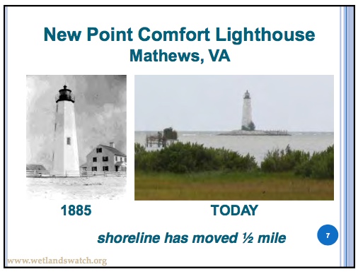
The platted subdivision only existed on paper because the project failed financially in 1905. Much of the barrier island and barrier beach were lost in the 1933 August and September hurricanes, and the rest lost through longshore transport after that.
The reports include those slides and a mocking cartoon about the “Coconut Telegraph,” alluding to person-to-person communication between Mathews citizens, as part of Power Point presentations made throughout Virginia and in other areas on sea level rise by MPPDC Executive Director, Lewie Lawrence.
When local observations are ignored in favor of political positions, everyone loses. Tax money is spent on the wrong responses and real problems get worse because they’re not acknowledged.
People who come from generations who’ve lived in the same place may not have the university degrees, but they have knowledge that could benefit the universities and government agencies who disregard them.
In the http://www.nad.usace.army.mil/Portals/40/docs/NACCS/NACCS_main_report.pdf”Hurricane Sandy report, the Corps of Engineers places barrier island and barrier beach preservation among the highest Coastal Storm Risk Management and Resilience measures, short of removing buildings from the coast.