Are Year-round Geese Part of the Water Contamination Problem?

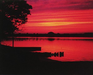
Sunset facing mouth of Queen’s Creek courtesy of Davie Cottrell©

Each impaired shellfish area has unique challenges, so this post is only about Queens Creek, which is listed in the 2007 Gwynn’s Island-Milford Haven watershed TMDL report. It states “septic systems should be a primary implementation focus because of health implications….” Like many official statements, it sounds good at first hearing, but if septic systems are failing near Queens Creek, why would the human contamination drop to 0% on any month’s reading, much less for 3 of 6 readings taken between October, 2005 to August, 2006? But Figure 4.6 B shows 74% for the average annual fecal coliform contributions from wildlife.

Residents on Queens Creek have seen the geese population go from staying half the year to settling in year-round. Does that have anything to do with the high wildlife contributions? Can’t tell from the reports because the details aren’t provided, only totals and percentages for ‘wildlife’.

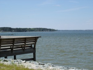
Mouth of Queen’s Creek courtesy of Davie Cottrell©

Other questions are, “Do the geese increase the phosphorus load too? Are they causing any additional shoreline erosion by eating young shoots?”

 And we need to consider whether there are other conditions that  are making the situation worse? Where are the computer models for evaluating the impact of the lack of dredging? The waters in Queens Creek used to be navigable, but they’re not for many craft today. If the Creek is dredged, would more water flow in and out with each tide change the capacity to process the impact of wildlife contamination? How much has settled in the silt at the bottom of the shallower creek to be stirred up by storms? (And on a separate point, if dredged material is spread in the sun, can the natural UV  disinfect it so it would then be usable to nourish the marshes that are being eroded by wave action and storms?)

But as things stand, continual contamination means the waters have no possibility of recovery naturally, so what happens to the areas further downstream?

The report acknowledges that for some areas, “water quality modeling indicates after removal of all of the sources of bacteria (other than wildlife), the stream will not attain standards under all flow regimes at all times. However, neither the Commonwealth of Virginia, nor EPA is proposing the elimination of wildlife to allow for the attainment of water quality standards….The reduction of wildlife or changing a natural background condition is not the intended goal of a TMDL.”

What is their plan? Even if all the effluent, pet and livestock elements are reduced as far as humanly possible, according to the 2007 report, the bottom line is the state agencies don’t plan to do anything–except change the assigned use of the waters–probably permanently.

It’s relatively easy for TMDL plans to go after the obvious 8% human element, 9% livestock and 9% pet contamination the state tests indicate. It’s not going to be easy to deal with the rising population of geese, but information is available about how to address the problem. Now we have to see if our state agencies are going to go beyond the obvious and deal with the 74% of bacterial contamination attributable to wildlife. Wonder if we’ll find out on the 23rd.

TMDLs? Mathews Residents Need To Figure Out How to Play This Numbers Game on May 23, 2012

I don’t think you can find anyone who will say they want dirty, fecal-contaminated water in their rivers, creeks and bays. But there are no easy answers for how to clean them up, or even how to guess how many potential sources there are. Yes, I said guess, because most of the reporting comes from computer modeling based on computer generated land use maps. Short of going out and counting every dog, raccoon, deer and duck, the best we can do is an educated guess.

<<JUST IN: IMPLEMENTATION PLAN SIMILAR TO WHAT WE CAN EXPECT:Greenvale Creek Implementation Plan>>

But we can apply common sense and general knowledge to refine those computer models. We’re on a deadline here: a public meeting has been called for May 23rd at the YMCA in Hartfield, 6:30 – 8:30 pm, for Mathews, Middlesex and Gloucester residents.   DCR Meeting Notice 5-23   It’s up to us to show up and share what we know. We need to question what doesn’t make sense in the old reports too — before the same information is passed along to the plans that will follow this meeting.

Shellfish Factsheet What we know right now is the Department of Environmental Quality defines TMDLs (Total Maximum Daily Load) as “the total pollutant a water body can assimilate and still meet standards.” And there are 9 creeks feeding into the Gwynn’s Island/Milford Haven Watershed or Piankatank River and parts of the Piankatank that are impaired and have levels of fecal coliform bacteria that are too high for growing shellfish.

If more information turns up, I’ll add to this post. Links to the old reports follow, with maps that show the areas involved.  See you at the meeting on the 23rd!

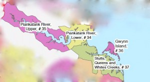
The impaired waters being discussed are located in these VA Dept of Health Shellfish Growing Areas

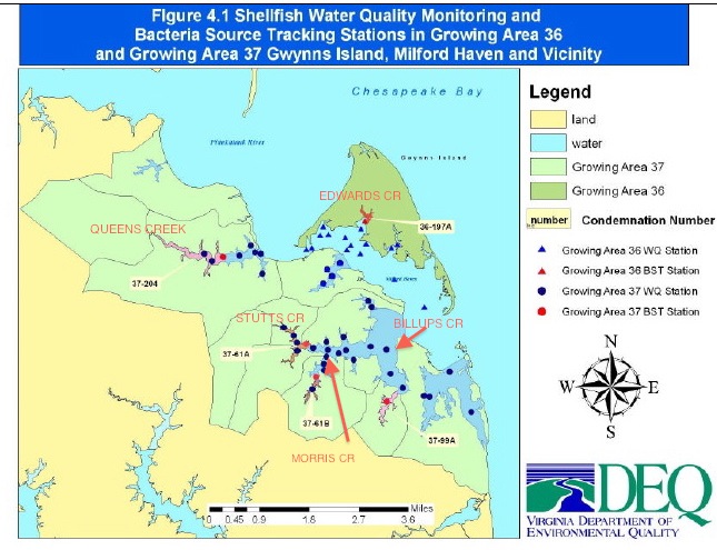
TMDL Report Gwynn’s Island and Milford Haven Watersheds

Gwynn’s Island and Milford Haven Watersheds shown in green

TMDL Lower Piankatank River

TMDL Modified Report Lower Piankatank River

TMDL Report Upper Piankatank River

5 Creeks in Gwynn’s Island-Milford Haven Watershed With Impaired Shellfish Waters


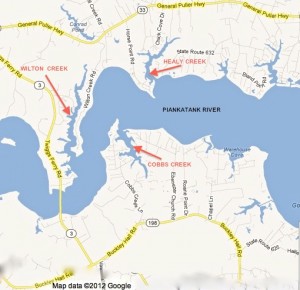
Wilton, Healy and Cobbs Creeks

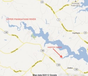
Upper Piankatank River and Harper Creek


Wetlands Plant Indicator Categories Changed — and so did the definitions

When I first wrote this story, I was excited that I received a helpful and rapid response from the U.S. Army Corps of Engineers within 3 hours of my emailed inquiry about the 2012 National Wetland Plant List:”Good timing with your message, the National Wetland Plant List (NWPL) has been finalized and a notice was published in the Federal Register today [May 9, 2012]… https://www.federalregister.gov/articles/2012/05/09/2012-11176/publication-of-the-final-national-wetland-plant-list.  The NWPL officially becomes effective on 01 June 2012.”

Loblolly pines are a familiar sight in Mathews

The 2012 National Wetland Plant List shows Pinus taeda (loblolly pine), and   Liquidambar styraciflua (Sweet Gum) as FAC.  FAC used to mean Facultative, equally likely to occur in wetlands or uplands.  I thought that with the new list recognizing plants like loblolly pine and honeysuckle as very adaptable and not limited to wetlands, the same idea would be carried through in the rest of the listings–and future wetlands delineation decisions would be more rational than in the past.

But not only did the panel add 1,472 plants to the original 6,728 species, they changed the definitions of their wetland indicator classifications as well.

OLD OBL – Obligate Wetland: Occurs almost always (estimated probablility 99%) under natural conditions in wetlands.
2012 OBL: Plants that always occur in standing water or in saturated soils

OLD FACW – Facultative Wetland: Usually occurs in wetlands (estimated 67% – 99%), but occasionally found in non-wetlands
2012 FACW: Plants that nearly always occur in areas of prolonged flooding or require standing water or saturated soils but may, on rare occasions, occur in nonwetlands

OLD FAC – Facultative: Equally likely to occur in wetlands or nonwetlands (estimated probability 34%-66%)
2012 FAC: Plants that occur in a variety of habitats, including wetland and mesic to xeric nonwetland habitats but often occur in standing water or saturated soils

OLD FACU – Facultative Upland: Usually occurs in nonwetlands (estimated probability 67-99%), but occasionally found on wetlands (estimated probability 1%-33%)                       
2012 FACU: Plants that typically occur in xeric or mesic nonwetland habitats but may frequently occur in standing water or saturated soils

OLD UPL – Upland: Occurs in wetlands in another region, but occurs almost always (estimated probability 99%), under natural conditions in nonwetlands in the regions specified. If a species does not occur in wetlands in any region, it’s not  on the National list.
2012 UPL: Plants that almost never occur in water or saturated soils

If the new FAC had stayed with “equally likely to occur in wetlands or nonwetlands,” we’d be in good shape. As it is, future delineations are probably going to be wetlands-biased, especially when FACU includes plants that grow in xeric (arid) regions, but also in standing water or saturated soils. They must be counting flash floods after storms to get that one in.

Take a few minutes and read the Federal Register entry. It provides some interesting background information on the comments from those on the reviewing panel who did not agree with the final decisions. Perhaps the planned challenge studies to test the new list will bring some adjustments. And when they set up the system again to search by county, it might be a good idea to download the local listings before visiting a nursery for landscape plants. Save those labels so you know the scientific names of whatever nonwetland plants you add to your plantings.

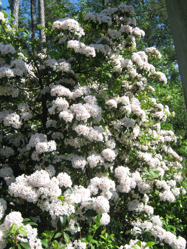
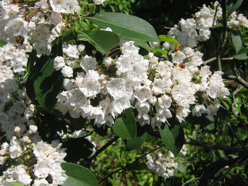
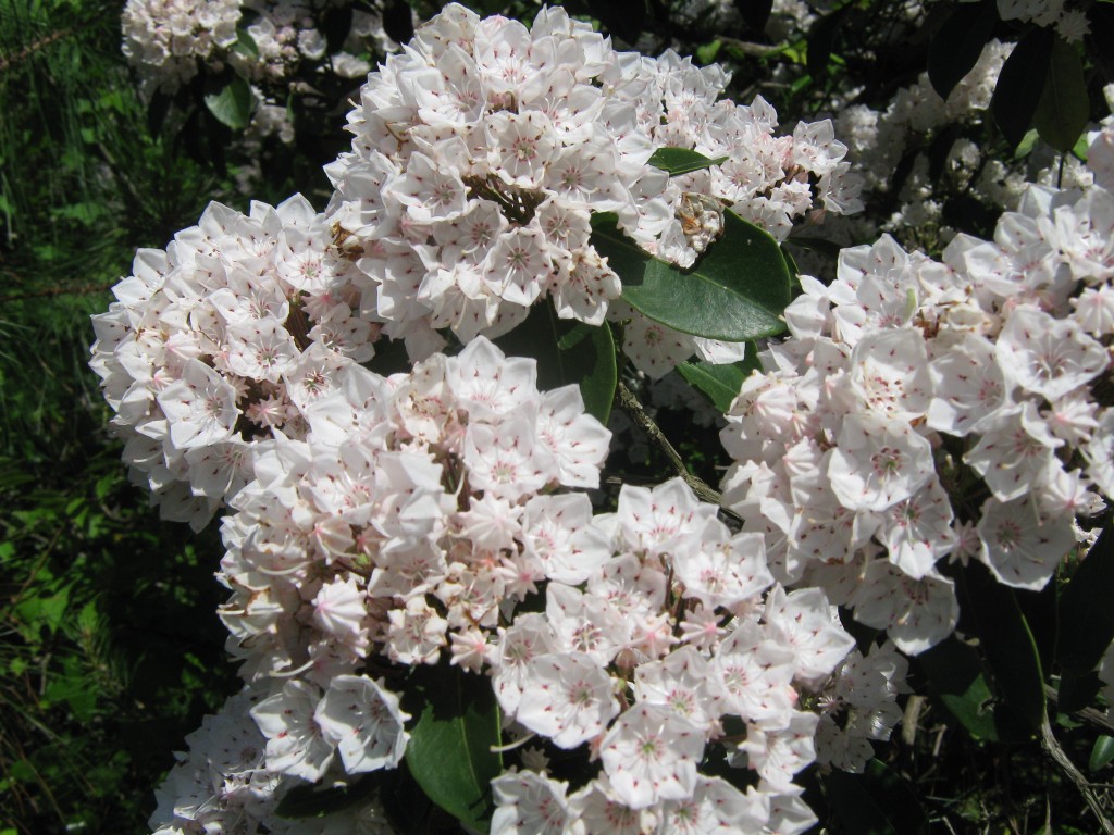
To leave you on a pleasant note, these are mountain laurel, Kalmia latifolia – FACU, growing in Mathews, and they aren’t in standing water or saturated soil.

Mountain Laurel (Kalmia Latifolia)  FACU

Mountain Laurel (Kalmia latifolia) FACU